Echo Canyon Grottoes
Easy
1 mi round trip+200 ft30–60 min
A short walk down from the Echo Canyon lot to grottoes and narrow passages in the rock. No permit.
 National
Arizona · Park 64 / 64
The newest national park: a sky island of rhyolite pinnacles the Chiricahua Apache called the Land of Standing-Up Rocks.
About 27 million years ago the Turkey Creek Caldera, a volcano roughly 12 miles across just south of today's park, erupted and buried this range in ash. The ash compacted into rhyolite tuff, and water, frost, and time have been splitting it ever since. What is left is thousands of pillars, spires, and balanced rocks standing in a pine and oak forest, rising out of the desert grassland of the Sulphur Springs Valley.
The Chiricahua Apache, the people of Cochise and Geronimo, called this the Land of Standing-Up Rocks. Swedish immigrants Neil and Emma Erickson homesteaded at the mouth of Bonita Canyon in the 1880s, and their daughter Lillian and her husband Ed Riggs built the first trails and guided guests into what Lillian called a Wonderland of Rocks. Their push led to a national monument in 1924. The Civilian Conservation Corps built the road to Massai Point and much of the trail system in the 1930s. On October 20, 2026, Congress and the President made it the 64th national park, Arizona's fourth.
Come for the rock formations. Stay for the night sky, since this is an International Dark Sky Park. Read the story, check NPS alerts before you go, and when you leave, mark it visited.
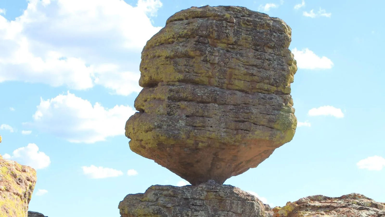
Our 17 miles of trails will take you into a wilderness of rocks.National Park Service, Chiricahua National Park
Six ways to spend your time, almost all of them along one 8-mile road from the entrance up to Massai Point.
Eight paved miles from the entrance up to Massai Point, climbing past the visitor center into the rock formations. No vehicles over 24 ft beyond the campground.
The signature driveA 360-degree view over the pinnacles from 6,870 ft, with a CCC-era exhibit building and a half-mile nature trail at the top.
Everyone · 30 minAbout half a mile and 200 ft down from the Echo Canyon lot to tunnel-like grottoes worn into the rhyolite.
Everyone · 30–60 minThe Heart of Rocks route passes Mushroom Rock, Big Balanced Rock, and Pinnacle Balanced Rock on a strenuous 7.3-mile day.
Full day · confident hikersThe Erickson family homestead and guest ranch at the mouth of Bonita Canyon, plus the 1880s Stafford Cabin. House open hours vary, so check at the visitor center.
Everyone · 1 hrAn International Dark Sky Park since 2021. NPS suggests Massai Point, the Echo Canyon trailhead, or the campground, away from the full moon.
Everyone · after darkAnswer a few questions right here. We'll map your day, stop by stop, with a route, timings, weather, and a packing checklist grounded in real park data. No account, no leaving this page.
⚡ In a hurry? Adventure Light 5 questions →Distances, climbs, and times from the park's own 2026 hiking guide and trail pages. Most trailheads are along Bonita Canyon Drive.
A short walk down from the Echo Canyon lot to grottoes and narrow passages in the rock. No permit.
A level walk past the 1930s CCC camp site to Stafford Cabin. One of the few trails where leashed dogs are allowed. No permit.
Climbs to the park's high point at 7,310 ft and a CCC-built fire lookout that is still staffed in summer. No permit.
The best single hike for the pinnacles: Echo Canyon, Hailstone, and Ed Riggs trails, hiked counterclockwise. Hailstone has exposure if you mind heights. No permit.
Climbs through a burn area to Picket Park, with the rhyolite bridge viewed from a distance. Trailhead is about 1.4 mi past the visitor center. No permit.
From Echo Canyon to Big Balanced Rock, Pinnacle Balanced Rock, and the Heart of Rocks loop, hiked clockwise. From the visitor center it gains 1,600 ft; NPS says not to start that version after 1 pm. No permit.
No permit for day hikes · no bikes or e-bikes on any trail · dogs only on lower trails (Bonita Creek, Silver Spur Meadow, Faraway Ranch area) · the hiker shuttle has not run since fall 2025
Four ecosystems meet on this mountain range, and more than 1,000 plant species grow in the park. Tap any animal to learn its story.
In fall and winter, bands of females and young work the lower canyons near Silver Spur Meadow and the campground. Adult males mostly travel alone.
Social, noisy, and often unafraid of people. NPS asks visitors not to feed them.
A small white-tailed deer that NPS describes as very common in the park and well adapted to desert life.
Its U.S. range is small, but it can be seen in the park, along with the Chiricahua fox squirrel.
One of the reptiles NPS lists for the Chiricahua sky island. Watch sunny rock faces along the trails.
About 200 bird species have been documented here, including 13 kinds of hummingbirds, which is why the area is listed as an Important Bird Area.
Grows along the park's streamside corridors in the canyon bottoms.
Named by NPS as part of the sky island mix, where Rocky Mountain, Sierra Madre, Sonoran, and Chihuahuan plants meet.
Easy to spot by its square-plated bark, which looks like alligator hide. NPS names it among the park's sky island trees.
The pinnacles are rhyolite tuff from the Turkey Creek Caldera eruption, about 27 million years ago.
"Chiricahua" comes from an Opata word for wild turkey, according to the 1700s writer Juan Nentvig.
It was named the 104th International Dark Sky Park in 2021, five years before it became a national park.
Massai Point is named for Massai, a Chiricahua Apache man; the Riggs family asked that the overlook carry his name.
The questions people actually ask, answered from the park’s own current guidance. Each answer links back to the National Park Service page it came from.
No. Chiricahua National Park has no entrance or parking fees, and the park does not sell passes. Camping at Bonita Canyon Campground is the only fee, paid through Recreation.gov. Source: NPS.gov
With two to four hours, the 3.3-mile Echo Canyon Loop (about 560 ft of climbing) covers the densest pinnacles. With a full day, the strenuous 7.3-mile Heart of Rocks Loop reaches Big Balanced Rock and Pinnacle Balanced Rock. Source: NPS.gov
Yes, on a leash no longer than 6 ft, in the campground, paved parking lots, and the lower trails: Bonita Creek, Silver Spur Meadow, and the Faraway Ranch area. Dogs are not allowed on trails above 5,500 ft, including Echo Canyon, Heart of Rocks, Natural Bridge, and Sugarloaf Mountain. Source: NPS.gov
Yes, at Bonita Canyon Campground near the visitor center. It is reservation only on Recreation.gov, vehicles and trailers must be under 29 ft including racks, and it often fills in March, April, and on holidays. Source: NPS.gov
Mostly the name. Chiricahua National Monument, protected since 1924, was redesignated Chiricahua National Park when the Chiricahua National Park Act was signed on October 20, 2026. Entry is still free, and some NPS pages may still use the monument name for a while. Source: NPS.gov
Chiricahua's own Field Journal stories are on the way. Until then, these cover the trip around it.
Log the visit, keep your story, and watch the map of all sixty-four fill in behind you. Every visit has a keepsake worth holding.
See the full map and track every park you have visited.
View the map → PlanTurn Chiricahua into a road trip with a custom, day-by-day itinerary.
Start planning → NearbyArizona's cactus forest, on either side of Tucson, the nearest big airport.
Open the guide → Explore moreFind your next park anywhere in the country.
Browse parks →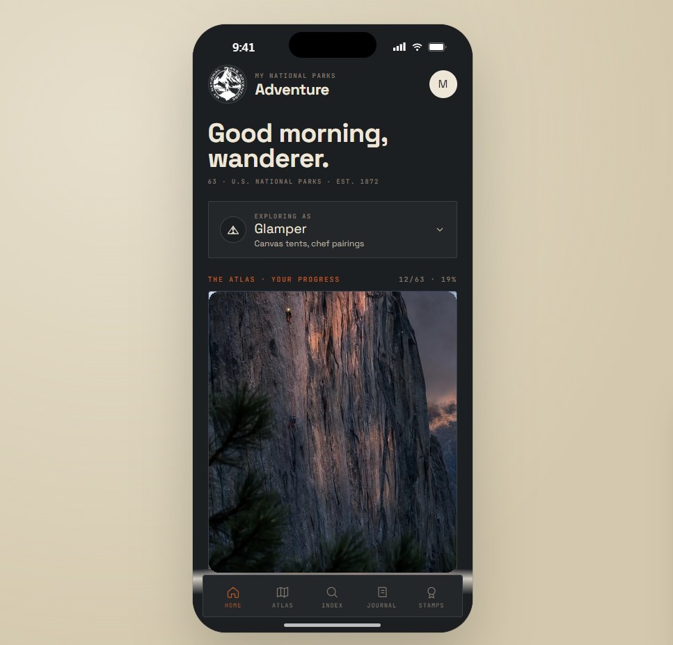
Offline maps, your passport, and every park in your pocket on the trail.
Join the waitlist →
The printed edition, part atlas, part journal, one story per park.
Notify me →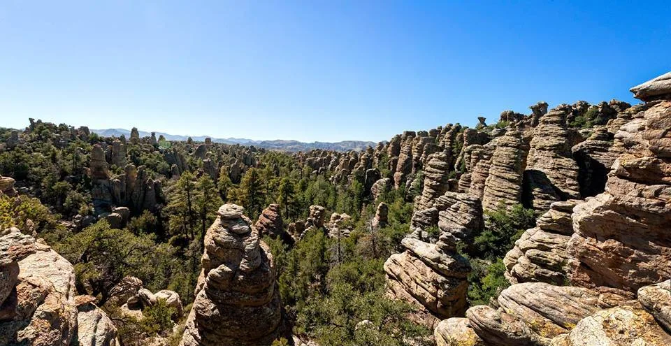
Park-guide posters, enamel stamps, and the passport book to fill in.
Visit the shop →Field Notes
The parks do not perform for anyone. They stood here before the road, and they will stand here after it.