
On June 22, 1969, the Cuyahoga River caught fire near a steel plant in Cleveland. It burned for less than half an hour, scorched a couple of railroad bridges, and didn't even make the local paper's front page the next morning. It became one of the most famous rivers in the country anyway, cited in textbooks as the spark, almost literally, for the modern environmental movement.
That gap between how small the fire actually was and how large it grew in memory is worth sitting with before anything else here, because it's the same gap that runs through this whole park. Cuyahoga Valley National Park is squeezed into the working corridor between Cleveland and Akron, no admission fee, no dramatic peaks, nothing that looks like Yellowstone. What it has instead is a river its own century tried to write off, and thirty three thousand acres of proof that a working landscape can come back a lot further than anyone standing here in 1969 would have guessed. Five stops, roughly the order a drive down through the valley would take you, trace how that happened, and how much of it had almost nothing to do with any law at all.
The Last Lock That Still Works
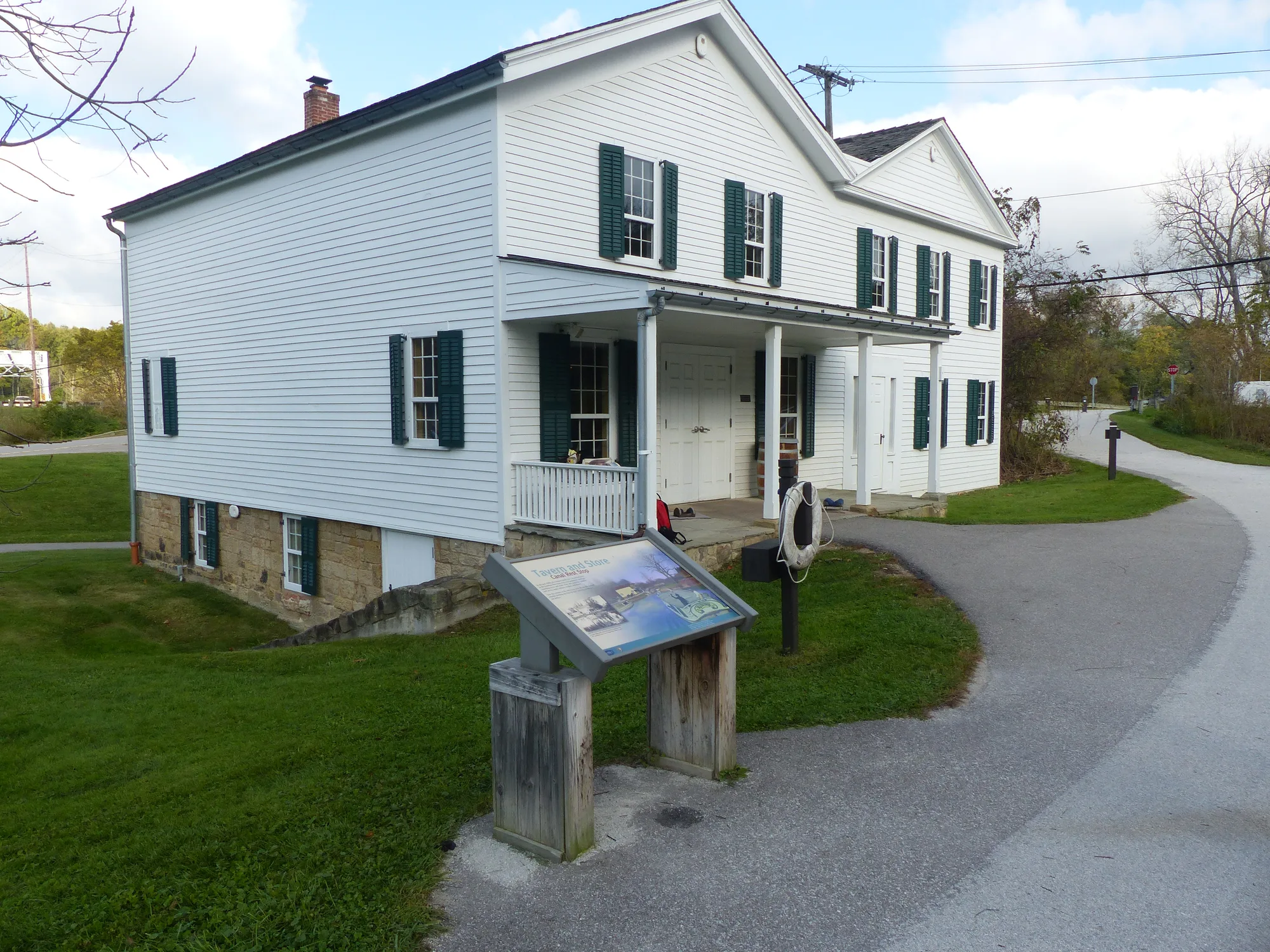
The Cuyahoga had caught fire more than ten times over the previous century by the time it did it again on June 22, 1969, near a steel plant a few miles north of here. Cleveland barely blinked. The fire did minor damage to a couple of railroad bridges, burned for less than half an hour, and no photo of it even ran in the next day's paper. It became a national story two months later anyway, when Time magazine picked it up in a brand-new section called Environment and described the Cuyahoga as a river that "oozes rather than flows." The image stuck for reasons that had less to do with the fire itself than with timing: the country was already primed to see it as proof, and the Clean Water Act followed within three years.
The lock next to this building is a smaller, older story about the same valley. Lock 38, also called Twelve Mile Lock, is the only one left on the entire Ohio and Erie Canal that actually still operates, rebuilt to demonstrate what dozens of others like it once did up and down this route. The trick is closer to a bathtub than an engineering marvel: valves let water in or out of the chamber until it matches whatever level a boat needs next. The canal ran 308 miles from Cleveland to Portsmouth, dug mostly by Irish and German laborers between 1825 and 1832, and it changed the region's economy fast. Before it opened, Cleveland shipped out roughly 1,000 barrels of flour a year. Six years later, it was 250,000. The canal kept working until the flood of 1913 wrecked it too badly to repair, and it never moved a boat again.
- 1825–1832 OHIO & ERIE CANAL BUILT, CLEVELAND TO PORTSMOUTH
- JUNE 22, 1969 CUYAHOGA RIVER FIRE, UNDER 30 MINUTES
- 1970–1972 EPA FOUNDED, CLEAN WATER ACT PASSED
- DEC. 27, 1974 CUYAHOGA VALLEY NATIONAL RECREATION AREA ESTABLISHED
- OCT. 11, 2000 REDESIGNATED CUYAHOGA VALLEY NATIONAL PARK
A Building That Was Misfiled for Its Own History
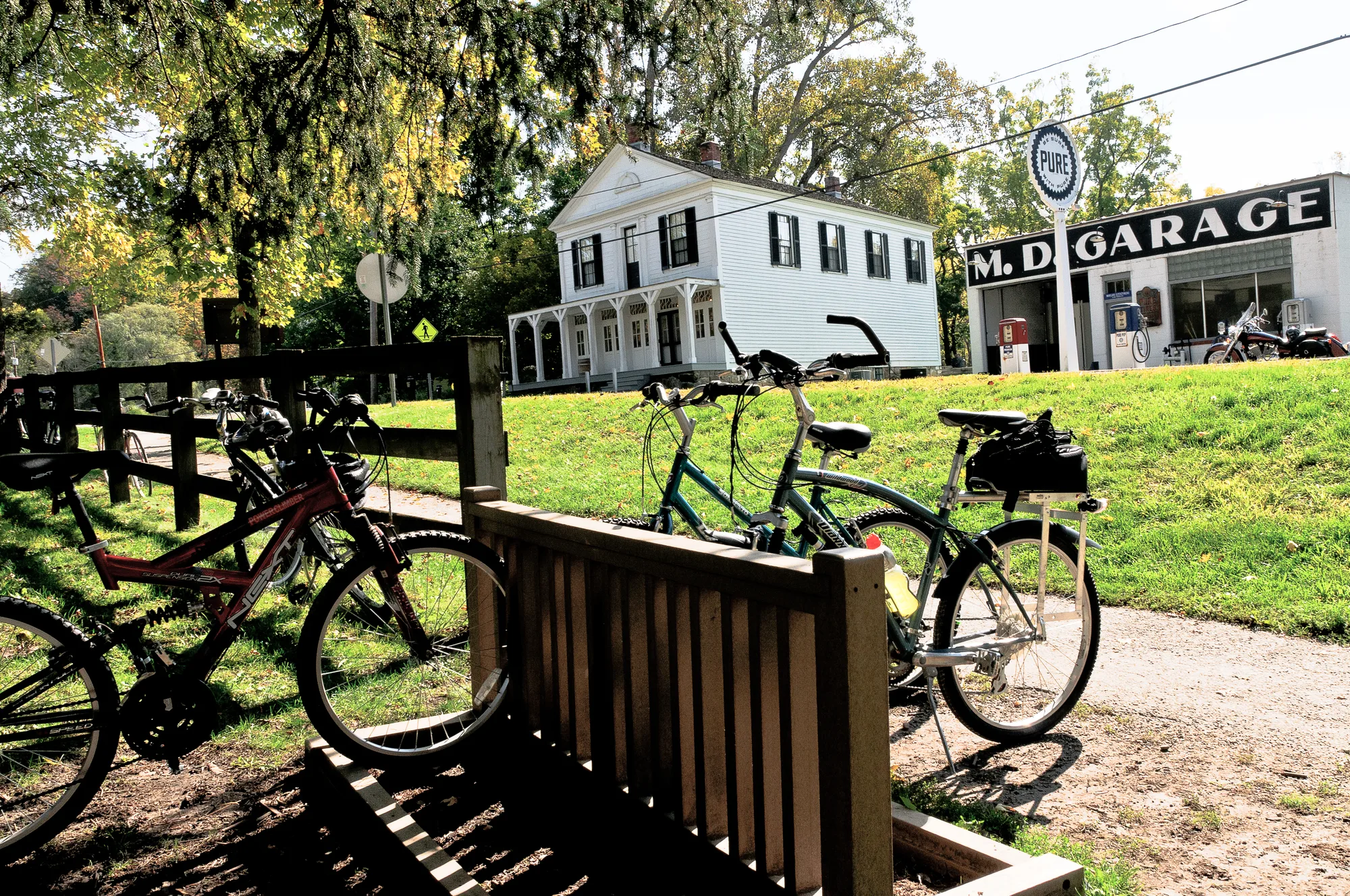
This store went up in 1835 for the Boston Land and Manufacturing Company, and it worked as a general store and the town post office until 1904, when the business closed and the building became a private home instead. When it was added to the National Register of Historic Places in 1979, the paperwork identified it as a completely different building, a tavern supposedly run nearby by a man named Jim Brown. Nobody caught the error for years, until the record was finally corrected and this building got its own name back. It's a small mistake for a federal database to sit with for so long, about a village most drivers on the interstate a mile away have never heard of.
The gravel path running past it is the Towpath Trail, twenty miles of it inside the park, laid directly over the ground mules once walked to tow canal boats along, at a pace slow enough that the towpath still runs exactly where the towrope needed it to. The independently run Cuyahoga Valley Scenic Railroad follows a version of that same corridor today, from Rockside Road near Cleveland down to Akron, popular enough with cyclists that plenty ride out one direction and let the train carry them and their bikes back the other way. Same route through the same valley, a different way of moving through it, the better part of two centuries apart.
Turn This Route Into a Real Plan
Pick your dates and your crew: the AI trip planner builds the day-by-day for Cuyahoga Valley, drive times between stops included.
Open the Trip PlannerHard Rock on Top of Soft Rock, Which Is the Whole Trick
The waterfall works because of two different rocks lying on top of each other. Berea Sandstone caps the ledge, hard enough to resist the water wearing it down, and it settled here about 320 million years ago. Underneath it sits Bedford and Cleveland shale, softer and far older, mud from an ancient seafloor compressed somewhere between 350 and 400 million years ago. Water erodes the soft shale first, faster than it can touch the sandstone above, and the cap rock is left overhanging until gravity does the rest. That's the 60-foot drop in front of you, still being carved out one shale layer at a time.
George Wallace built a sawmill at the top of the falls in 1814, and a grist mill and woolen mill followed soon after, enough industry to give the surrounding cluster of houses its own name, the Village of Brandywine. Most of it is gone now, not from fire or flood but from Interstate 271, built straight through the site decades later. One house survived: George's son James built a home nearby that still stands today as a bed and breakfast, the Inn at Brandywine Falls, the last physical trace of a village a highway simply drove through.
Stone Laid Down by a River That Isn't Here Anymore
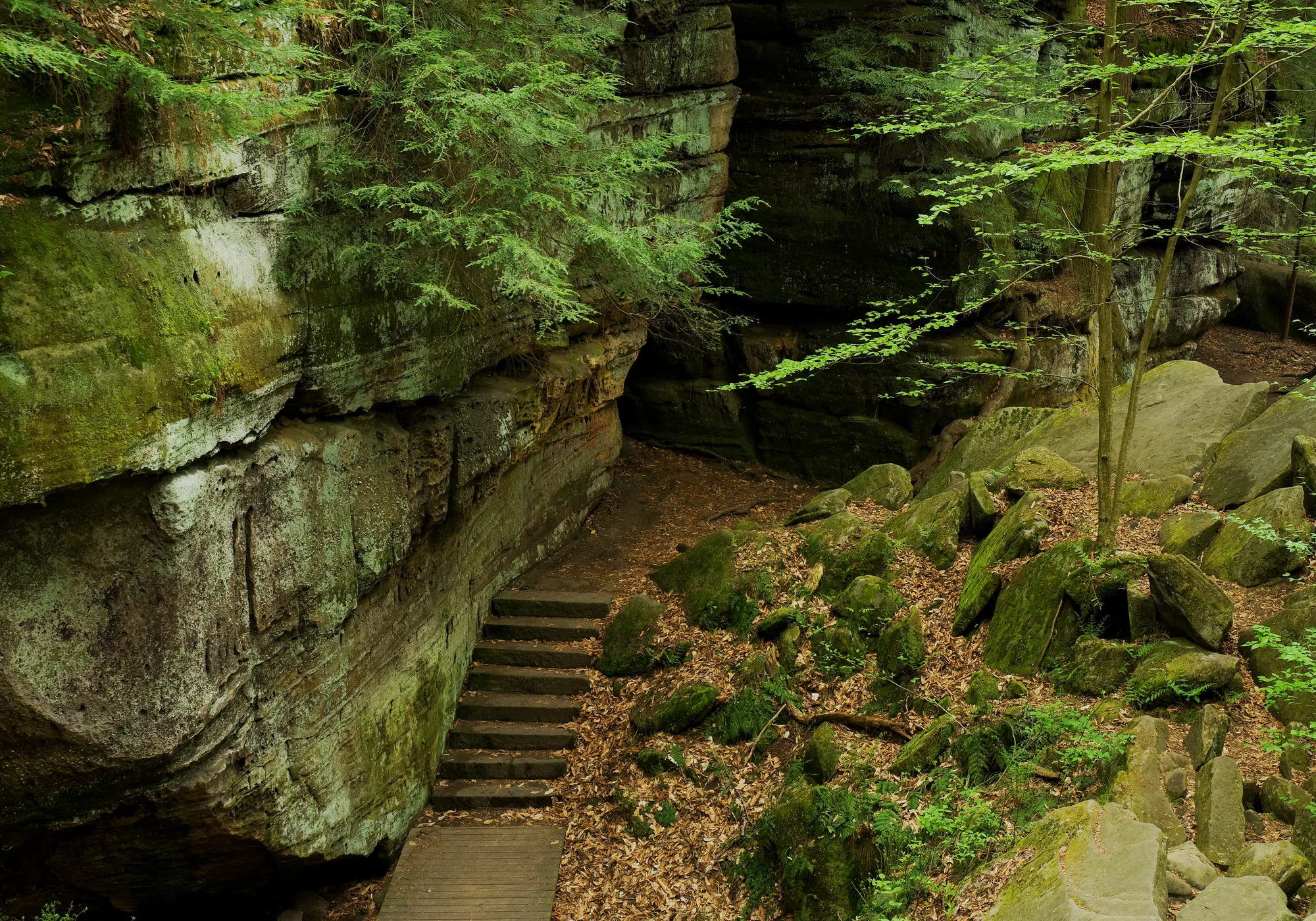
These cliffs are Sharon Conglomerate, sandstone studded with rounded pebbles of quartz cemented right into it, laid down millions of years ago by river systems that no longer exist anywhere near Ohio. People have been climbing on this rock recreationally since at least the 1800s, long before it was anyone's idea of a national park. What made it public wasn't a federal decision at all. It was one wealthy industrialist, Hayward Kendall, buying the land privately and establishing it as Virginia Kendall Park, named for his mother. The Civilian Conservation Corps built out trails and shelters here in the 1930s, decades before this valley became a National Recreation Area, let alone a national park.
The overlook near the trail's end catches sunset over the valley, the same view Kendall's own land made possible for the public before any government agency asked for it. The full loop runs about 1.8 miles, easy enough for most visitors, and it's still one of the most photographed corners of the park.
A Junkyard, Cleaned by Hand and Then by Animal
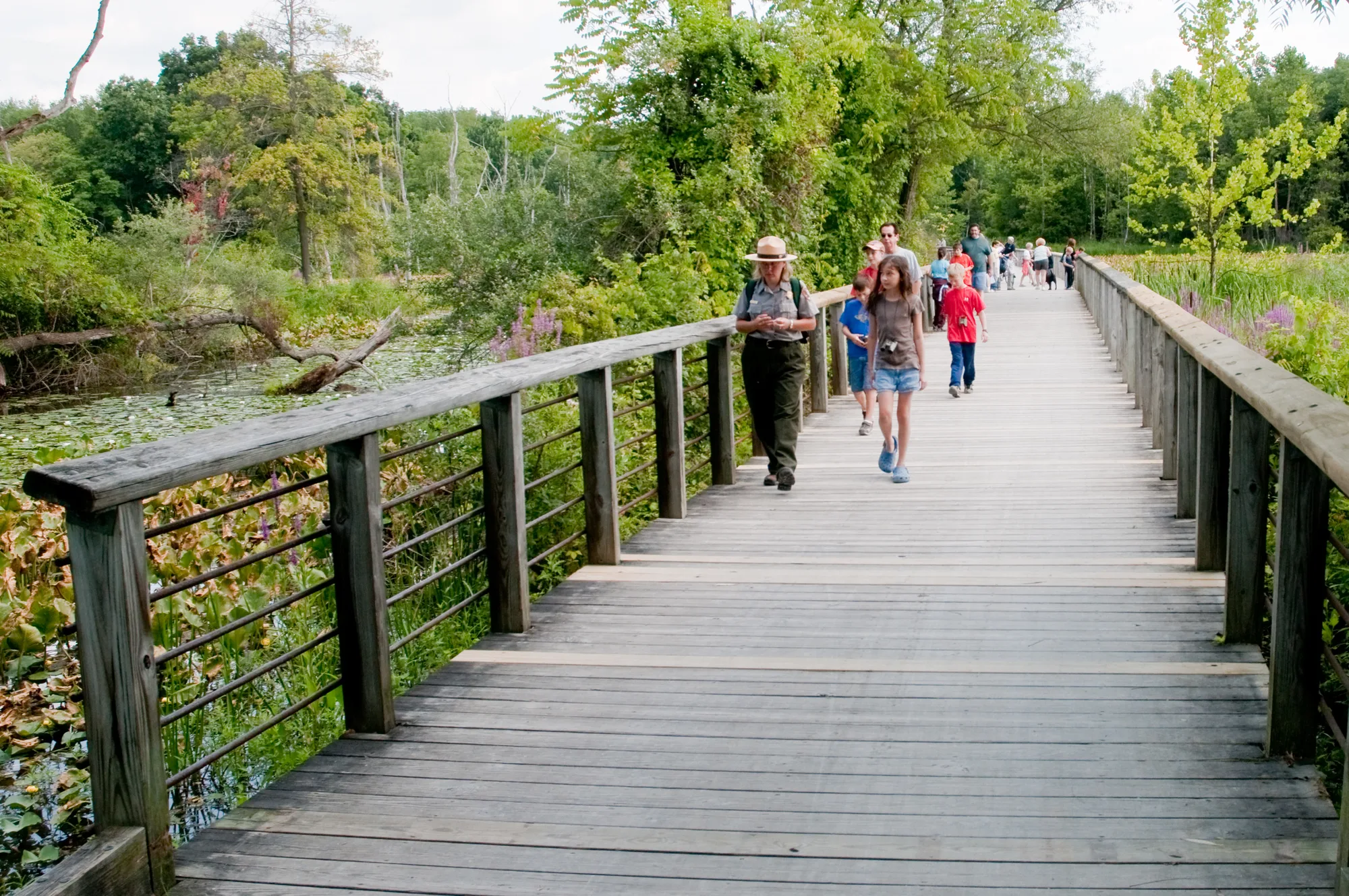
This 70-acre wetland used to be Burrell Tonkin's auto repair shop and salvage yard, car bumpers, tires, and scrap metal stacked along the old canal bed. In 1984, volunteers from the Cleveland and Akron area Sierra Club worked with the National Park Service to haul the junk out by hand, one of the earliest cleanup efforts in what would become this park. That would have been the whole story, a cleared lot, if beavers hadn't shown up on their own and finished the job differently than anyone planned. They built a dam across the old canal, flooded the cleared land, and woke up decades of dormant wetland seeds that had been sitting in the soil under the scrap metal the entire time. Nobody planted this marsh. It grew because water came back and the ground remembered what to do with it.
Ohio had no beavers left at all by 1830, trapped out entirely; the animals doing the work here are themselves a comeback story, not a constant. River otters followed a more deliberate path back, reintroduced to Ohio waterways starting in 1986 and now spread through improved stretches like this one. Great blue herons, painted turtles, frogs, and songbirds have all followed the water in since. The 565-foot boardwalk crossing the middle of it lets you see all of it without disturbing any of it, a former junkyard now popular enough to be one of the most visited stops in the entire park.
Back at the first stop, the river that caught fire for less than thirty minutes in 1969 still runs through this valley, past a working lock, an erased village, and a wetland that grew itself back over a scrapyard nobody thought to save. None of it happened because a law demanded it in advance. Most of it happened because people, and eventually a few beavers, decided a ruined stretch of ground was worth the trouble of undoing.
The 1969 fire's real duration, damage, and why it became a national story checked against NPS.gov's own "Story of the Fire" article. Lock 38, the canal's route and construction dates, the flour-shipment figures, and the 1913 flood checked against NPS.gov's Lock 38/Canal Exploration Center page and a National Park Service history of the Ohio & Erie Canal, cross-checked against Wikipedia for the park's own 1974/2000 designation dates. Brandywine Falls' geology and Boston Store's history (including the 1979 tavern misidentification, corrected years later) checked against NPS.gov's own Brandywine Falls and historic-places pages and the Wikipedia entry for the Boston Land and Manufacturing Company Store. The Ledges' geology and Hayward Kendall's land purchase checked against NPS.gov's Ledges page. The Beaver Marsh restoration story (the 1984 Sierra Club cleanup, the beavers' own dam, the otter reintroduction beginning 1986) checked against a historical-marker transcription (hmdb.org) and National Geographic's reporting on the site, cross-checked against NPS.gov's own Beaver Marsh page for current wildlife and the boardwalk.