
Three days gets you the real Yosemite: the granite walls everyone recognizes from a photo, a drive-up viewpoint that changes how the park feels, and either the high country or a river-carved trail out of the valley, depending on when you show up.
What three days does not get you is Half Dome's summit cables, a paddle across Tenaya Lake at sunset, or a guarantee that Tioga Road is open. This plan is built around what you can actually count on: the valley floor, one big drive-up viewpoint, the giant sequoias, and a third day that flexes with the season instead of pretending the season doesn't matter. It also assumes you're driving in on your own, since Yosemite Valley sits about 3.5 to 4 hours from San Francisco and roughly 6 from Los Angeles, and there's no way around spending real time on the road to get here.
Tunnel View, the Falls, and Cook's Meadow
This is the day that explains why Yosemite Valley gets photographed more than almost anywhere else in the park system.
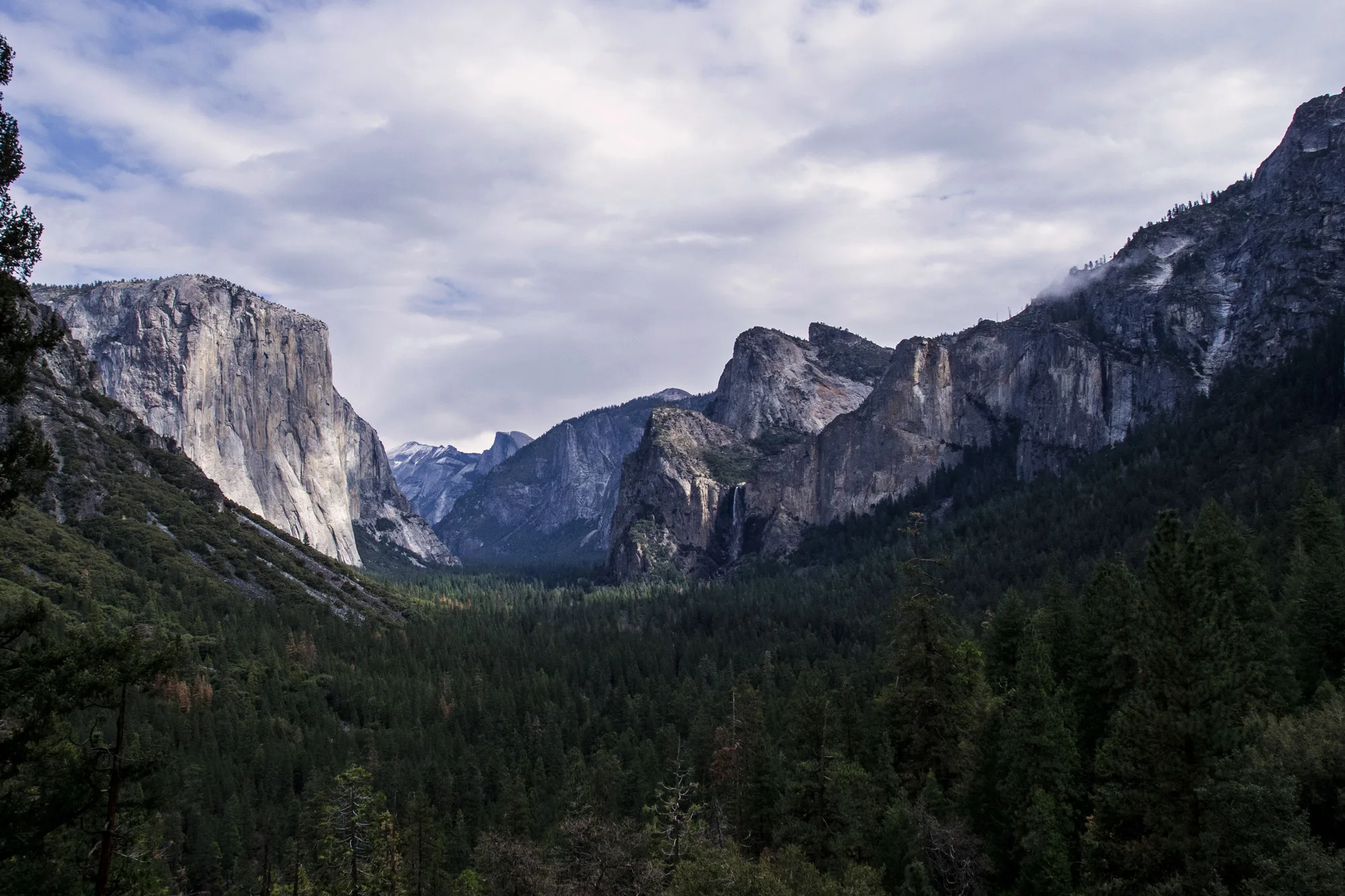
Start at Tunnel View on Wawona Road before the parking turnouts fill, since this is the pullout where you see El Capitan, Bridalveil Fall, and Half Dome lined up in a single frame, and it's the shot most people drive four hours for without realizing it's a five-minute stop. From there, drop down onto the valley floor and walk the short, paved path to the base of Bridalveil Fall, which runs heaviest in spring and thins to a mist by late summer. El Capitan Meadow is next, mostly for the vertigo of looking straight up 3,000 feet of blank granite and, if you're there in spring, spotting climbers as small as pixels partway up the wall.
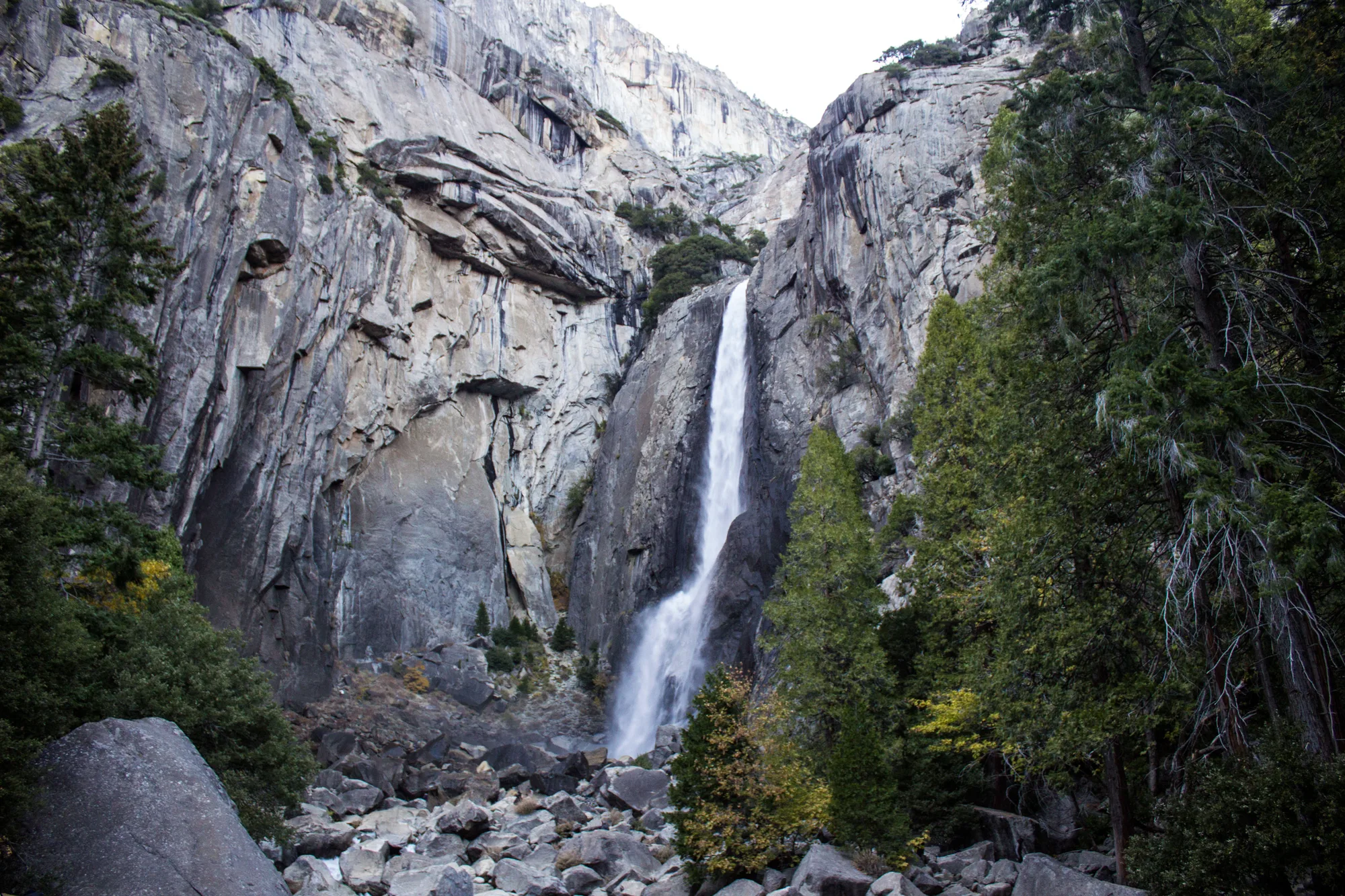
Lower Yosemite Fall is an easy, mostly flat loop from its own parking area and takes maybe 30 to 45 minutes round trip, worth it even if the fall itself is reduced to a trickle by August, since the boulder field and the scale of the cliff above it are the point as much as the water. Spend the rest of the afternoon on the Cook's Meadow Loop, a flat mile that circles an open meadow with unobstructed views of Half Dome, Sentinel Rock, and Yosemite Falls without requiring a single switchback. Yosemite Valley runs a free shuttle loop connecting most of these stops, and using it instead of re-parking at each pullout saves real time, since valley parking fills fast even without a reservation system in place.
Plan to eat lunch in the valley and save your legs, because day two involves more driving than walking but the payoff views are worth arriving early for.
The View From Above, and the Sequoias
Glacier Point puts you eye level with Half Dome's face; getting a permit to stand on top of it is a separate, much harder project.
Glacier Point Road climbs about 30 miles from the valley to a viewpoint that puts you roughly 3,200 feet above the valley floor, close enough to Half Dome that its cables are visible with the naked eye and you can trace Nevada and Vernal Falls below. The road is seasonal and gated by snow; in 2026 it opened to vehicles on May 9, and in a typical year it runs from sometime in May into November, so if you're planning a spring or late-fall trip, check nps.gov/yose before you build your day around it. Budget the better part of a morning for the drive out, the walk to the point, and the drive back, since it's not a quick detour.
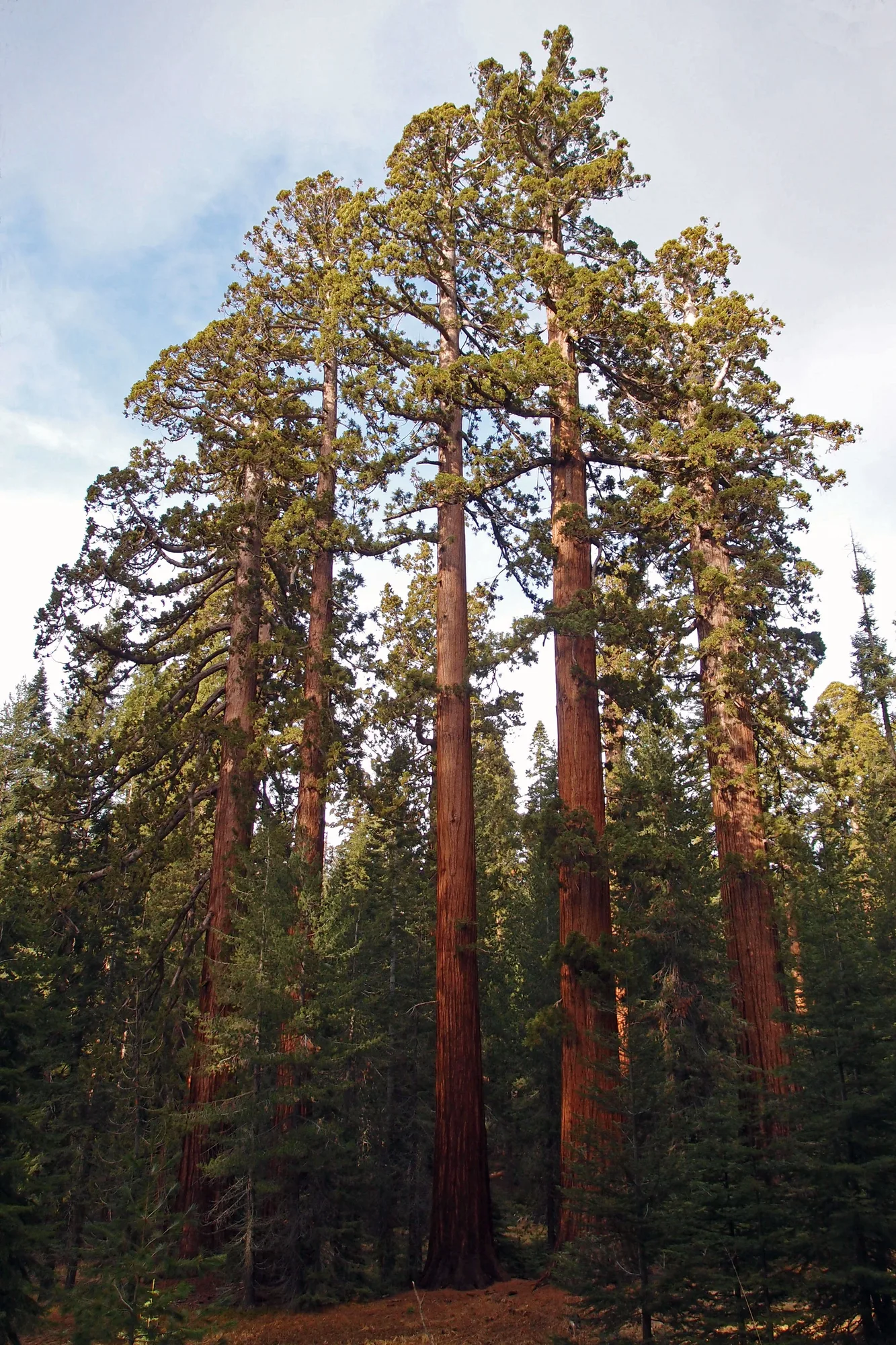
In the afternoon, head to Mariposa Grove near the park's south entrance to walk among sequoias that predate the park itself, including the Grizzly Giant, which is well over 1,800 years old. Parking is no longer allowed at the grove directly; you park at the Welcome Plaza and ride a shuttle in, which adds time but keeps the crowds and vehicles off the trees' root systems. The Grizzly Giant Loop is about 2 miles and manageable for most fitness levels, with a longer loop available if you want more grove and fewer people.
This is also the honest place to talk about Half Dome's cables, which most visitors will not get to use. The National Park Service runs two lotteries: a preseason lottery in March for the whole season, where roughly a fifth of applicants succeed, and a daily lottery two days before each hike date with somewhat better odds on weekdays than weekends. Permits cost $10 per person, charged only if you win, and the cables themselves are typically only up from late May through mid-October. None of that fits cleanly into a first-time 3-day trip planned less than two months out, so treat Half Dome's summit as a separate goal to plan for on its own, not a box to check this visit.
The High Country, or Vernal Fall
Your third day depends on one thing you can't control from home: whether Tioga Road is open.
Tioga Road, the only route into Tuolumne Meadows and the park's high country, is plowed and reopened each spring, and the timing shifts year to year with snowpack. It opened May 15 in 2026; in a typical year it's closed until late May or June and stays open into November. If it's open when you visit, this is the better day: drive up to Tuolumne Meadows for a completely different landscape than the valley, subalpine meadows ringed by granite domes at nearly 8,600 feet, with short walks around Tenaya Lake and up Lembert Dome, plus temperatures that run 15 to 20 degrees cooler than the valley floor in summer. Afternoon thunderstorms build fast in the high country from July through early September, so plan any exposed hiking for the morning.
If Tioga Road is closed, which is likely for spring or late-fall trips, the better move is the Mist Trail to Vernal Fall. It's about 3 miles round trip to the top of Vernal Fall with roughly 1,000 feet of elevation gain up wet granite steps that earn the trail its name, and it stays busy nearly all season because it's genuinely one of the best short hikes in the park. A flatter option is the full Valley Loop Trail, about 11 miles around the entire valley floor, or just a shorter chunk of it if a full loop doesn't fit your day. Neither requires a permit or a lottery, which after day two's Half Dome conversation is a nice change of pace.
One detail worth knowing before you commit to either version of day three: the free valley shuttle doesn't reach Glacier Point, Mariposa Grove, or Tuolumne Meadows. All three require your own vehicle, or in summer, YARTS bus service along Highway 120 and the seasonal Tuolumne hiker's bus. If you're not driving, build that into your planning well before you land in the valley.
Put together, these three days trade a little bit of certainty for a lot of range: a guaranteed valley floor day, a viewpoint day that depends on a road that's usually but not always open by your travel dates, and a third day that only fully reveals itself once you know whether Tioga Road has opened for the season. That's not a flaw in the plan, it's just how Yosemite works at 4,000 to 8,600 feet of elevation change. Check current conditions on nps.gov/yose a few days before you leave, and build in one buffer activity, like a second pass through Cook's Meadow at golden hour, in case a road closes on you.
Turn This Into Your Trip
Answer five quick questions and get a day-by-day plan for Yosemite, built around your real dates, your crew, and your pace.
Plan This Trip →Checked directly against nps.gov/yose in August 2026: the park's February 2026 news release confirming no timed vehicle reservation system for 2026 (nps.gov/yose/learn/news, "Yosemite National Park will not require vehicle reservations in 2026"); the Tioga and Glacier Point roads page (nps.gov/yose/planyourvisit/tioga.htm) for 2026 opening dates (Glacier Point Road May 9, Tioga Road May 15) and typical seasonal ranges; the Half Dome permits page (nps.gov/yose/planyourvisit/hdpermits.htm) for the $10 per-person fee, the preseason and daily lottery structure, and the typical late-May-to-mid-October cable season; the Half Dome permit statistics page (nps.gov/yose/planyourvisit/hdpermitsapps.htm) for lottery success rates, which reflect the most recently published season and can shift year to year; the park's entrance fees page for current rates; and the Mariposa Grove page for the Welcome Plaza shuttle setup. Road openings, reservation policy, and permit odds all change year to year in Yosemite, sometimes significantly, so confirm current status on nps.gov/yose before you finalize dates.