
Yellowstone covers roughly 2.2 million acres and its main road is built like a figure eight. Four days is enough to drive the whole loop and see the park's signature landscapes, but only if you accept that some of those days are mostly spent in the car.
No reservation is required to enter Yellowstone. As of the 2026 season the park has no timed-entry or vehicle-reservation system, unlike some other high-traffic parks; you just need a valid pass at the gate. A private vehicle pass runs $35 and covers 7 consecutive days, an individual walk-in or bike-in pass is $20, and a Yellowstone-specific annual pass is $70. What does book up, often months out, is lodging and camping inside the park, so nail that down before you fix your dates.
This plan assumes you're doing the full Grand Loop counterclockwise from the west side, starting near Old Faithful and ending in the northern range, which is how most people build it when flying into Bozeman or Jackson. If your dates fall in April or early May, check the park's current road status before you go: the North and West entrances typically open in mid-April, and the rest of the interior road network opens in stages through May as snow gets plowed, weather permitting. Most of the Grand Loop is open by late May and stays open until early November.
The Geyser Basins
Start where most people's mental image of Yellowstone actually lives, and get it out of the way while your legs are fresh.
If you're coming from the West Entrance, it's about 30 miles to Old Faithful, roughly 45 minutes to an hour once you factor in the entrance station and the wildlife jams that build up along the Madison River. Time your arrival for the first or second Old Faithful eruption of the day if you can; the visitor center posts predicted times with a plus-or-minus window, and the crowd is smaller before mid-morning. The eruption itself lasts 1.5 to 5 minutes, so don't rush straight up to the rope line and then wander off.
After Old Faithful, walk the boardwalk loop through Upper Geyser Basin rather than driving straight to the next stop. Castle Geyser, Grand Geyser, and Riverside Geyser are all within a mile or two of the visitor center, and Morning Glory Pool sits at the far end of the loop with the kind of blue-to-orange color banding that photographs better than Old Faithful itself. Stay on the boardwalks the entire time. The ground around these features is a thin crust over scalding water, and people have been seriously injured or killed by stepping off marked trails in thermal areas.
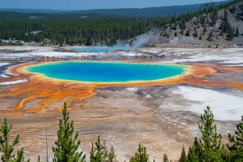
On the way south, stop at Midway Geyser Basin for Grand Prismatic Spring, the park's largest hot spring and the one with the rainbow color rings. The boardwalk view from ground level is good but flattened; if you have another 30 to 45 minutes, park at the Fairy Falls trailhead and walk the short spur up to the Grand Prismatic overlook for the view from above that makes this spring famous in photos.
Finish the day at West Thumb Geyser Basin, about 17 miles south of Old Faithful. It's a smaller basin but a strange one, with hot springs and geysers sitting directly on the shore of Yellowstone Lake, including a spring known as Fishing Cone that used to let anglers cook a trout without taking it off the hook. Give it 30 to 45 minutes and you're done for the day.
Grand Canyon of the Yellowstone
This is the day the park stops looking like a geyser field and starts looking like a national park brochure.
Drive north from Old Faithful through Madison to Norris, then east to Canyon Village, about 42 miles total and roughly an hour and a half with stops. Canyon Village sits at the north end of the Grand Canyon of the Yellowstone, a 20-mile, up-to-1,200-foot-deep gorge cut by the Yellowstone River through rock that thermal activity has cooked into yellows and oranges, which is where the park's name actually comes from.
Work both rims. On the North Rim, Lookout Point and Grand View give you the Lower Falls from across the canyon; the walk down Uncle Tom's Trail on the South Rim, a steep series of paved switchbacks and metal stairs, gets you closer to the base of the falls but is genuinely strenuous coming back up. Artist Point, also on the South Rim, is the classic postcard view of the 308-foot Lower Falls and worth the short walk from the parking area even if you skip everything else.
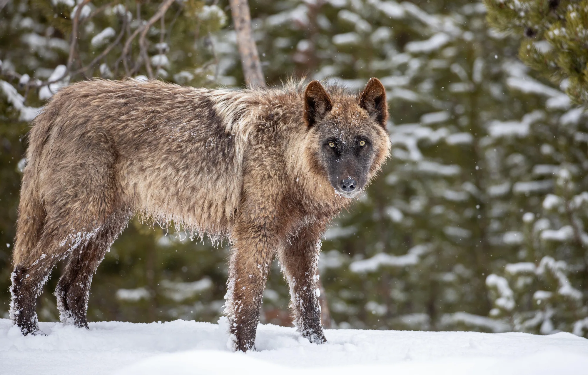
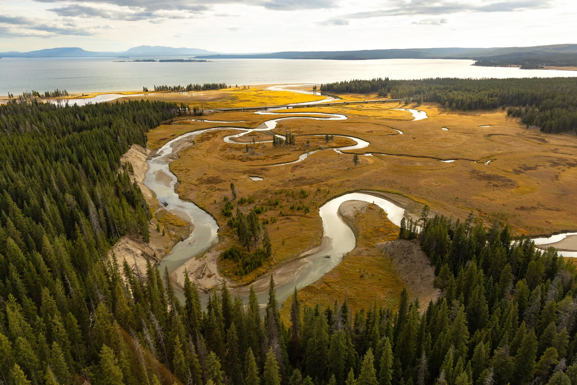
Spend the afternoon in Hayden Valley, a broad river basin between Canyon and Fishing Bridge that's one of the most reliable wildlife-viewing stretches in the park. Bison herds graze along the river most of the year, and it's a regular spot for grizzly bear and wolf sightings at dawn and dusk. Pull off at a designated turnout rather than stopping in the road, and keep your distance: NPS guidance requires staying at least 100 yards from bears and wolves and at least 25 yards from bison, elk, and other wildlife, no exceptions for a better photo.
Terraces and the Northern Range
The travertine terraces look like nothing else in the park, and the valley beyond them has the best wildlife odds of the whole trip.
From Canyon, head to Mammoth Hot Springs, either back through Norris (about 33 miles) or over Dunraven Pass through Tower-Roosevelt (about 37 miles and a slower, more scenic drive). Mammoth is built on travertine rather than the silica sinter you saw at Old Faithful, so the terraces grow and shift shape over months instead of staying fixed. Walk the boardwalks past Minerva Terrace, Palette Spring, and the tall travertine cone called Liberty Cap, then wander through the Fort Yellowstone historic district, a cluster of old cavalry buildings from the park's early administration that now houses park offices and often has elk lounging on the lawn between them.
Then drive east toward Tower Junction, about 18 miles, and continue into Lamar Valley. Tour operators and wildlife guides commonly call this stretch the "American Serengeti" for its wildlife density, and the nickname is earned: this is prime territory for wolf packs, grizzly and black bears, pronghorn, and large bison herds, especially in the early morning and evening. If you want to get out of the car, the Trout Lake trail near Pebble Creek is a short, steep half-mile loop up to a small lake that's a good stretch after a day of driving and boardwalks.
Keep the same wildlife distances here that applied at Hayden Valley. Lamar Valley draws roadside "bear jams" and "wolf jams" where people stop in the travel lane; use a pullout, and if rangers or volunteers have roped off a viewing area for an active predator sighting, that line is not a suggestion.
Norris Geyser Basin, Then Your Choice
The most volatile geyser basin in the park, plus a flex block to fix whatever the first three days didn't cover.
Start at Norris Geyser Basin, the hottest and most changeable thermal area in Yellowstone, home to Steamboat Geyser, the tallest active geyser in the world when it erupts, though its eruptions are unpredictable and can go years apart. Walk both loops if you have the time: Porcelain Basin is stark and open, with steaming ground and mineral-bleached earth, while Back Basin is forested and more spread out, with Steamboat and the deep blue Emerald Spring along the way. Plan on 1.5 to 2 hours for both loops.
What you do with the rest of the day depends on what you skipped. If the weather's good and your group is up for a moderate hike, the Mount Washburn trail from the Dunraven Pass trailhead is about 6.4 miles round trip with a real climb to a fire lookout at over 10,000 feet, and it's one of the better spots in the park for bighorn sheep. If a road closure or an eruption you missed threw off an earlier day, this is your buffer to backtrack rather than cramming a missed stop into a departure morning.
However you spend the afternoon, budget real time to get to your exit entrance. Distances from Norris run about 21 miles to Mammoth and the North Entrance, or back through Madison to the West Entrance, and traffic in Yellowstone rarely moves as fast as the map suggests.
Four days covers the Grand Loop's major stops without turning the trip into a windshield tour, but it leaves out the park's edges: the Bechler region in the southwest, the remote Thorofare in the southeast, and most of the backcountry that requires a permit and more than a day hike to reach. If this is your only visit for a while, that's the honest trade you're making by choosing four days over seven.
Turn This Into Your Trip
Answer five quick questions and get a day-by-day plan for Yellowstone, built around your real dates, your crew, and your pace.
Plan This Trip →Entrance fees and the confirmation that Yellowstone currently requires no vehicle reservation or timed entry were checked against nps.gov/yell/planyourvisit/fees.htm. Wildlife viewing distances (100 yards from bears, wolves, and cougars; 25 yards from all other wildlife, including bison and elk) were checked against nps.gov/yell/planyourvisit/safety-press.htm. Both points, plus the boardwalk/thermal-area hazard warning, were cross-checked against the park's own "Top 10 things to know" release for the 2026 summer season at nps.gov/yell/learn/news/26009.htm. Spring road-opening pattern was checked against the park's news release at home.nps.gov/yell/learn/news/25001.htm, which covers North and West entrance openings and the staged opening of interior roads through May; exact day-by-day 2026 opening dates should be confirmed on the park's current road status page before travel, since they shift year to year with snowpack. Driving distances between loop sections are approximate, drawn from the park's published road network and standard mileage between major junctions, and are meant as planning context rather than exact turn-by-turn figures. All of this was current as checked in August 2026; always verify fees, road status, and safety guidance directly on nps.gov before you travel, since park conditions change.