
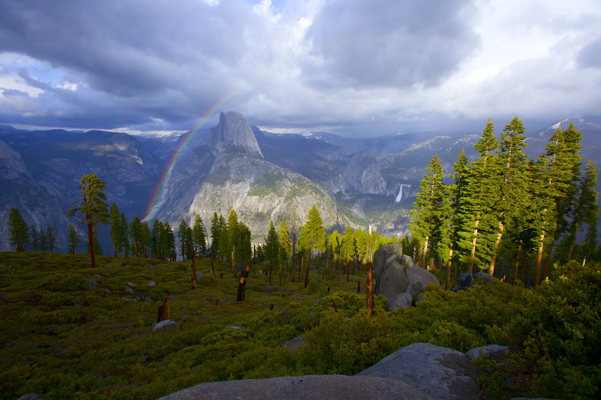
Half Dome is missing its other half. That is what the shape says, standing in the valley and looking up: a mountain sliced clean down the middle, one side a smooth curved back and the other a sheer face over 2,000 feet tall, like something took a blade to a dome and hauled the front away. Geologists will tell you, patiently, that this did not happen. Roughly eighty percent of the original rock is almost certainly still standing. What looks amputated from the valley floor is a ridge, a formation geologists call an arete, and the missing half is an illusion built entirely out of the one angle everybody views it from.
That is the trick this valley plays on nearly everything in it. Granite that looks permanent, uncarved, finished, is almost never what it appears to be up close. The walls are younger than they look. The valley floor is newer still. And the reason any of it survived to be looked at at all had less to do with a plan than with one very specific law, signed in the middle of a war, that nobody was fully sure would hold.
Everything at Once, and None of It Finished
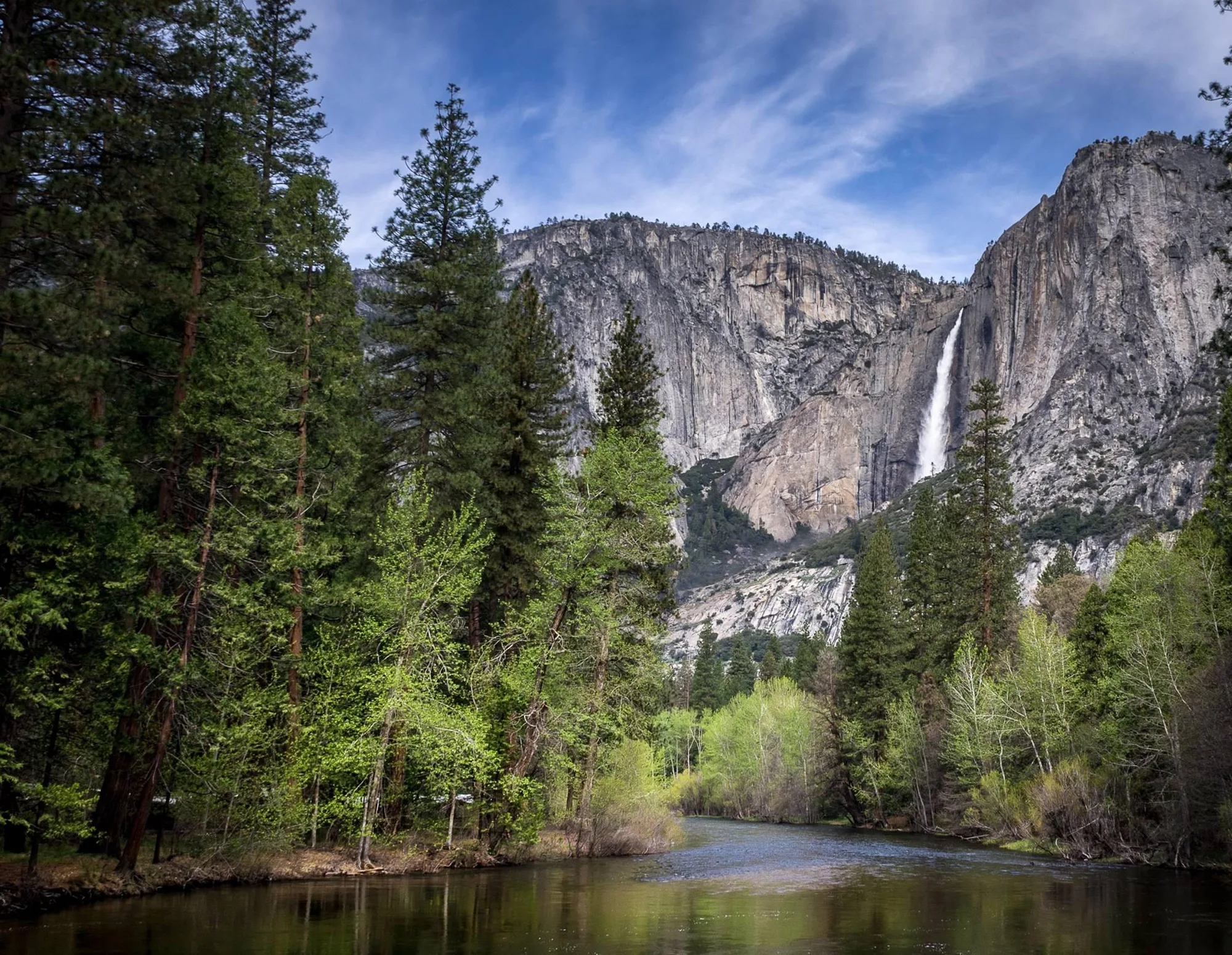
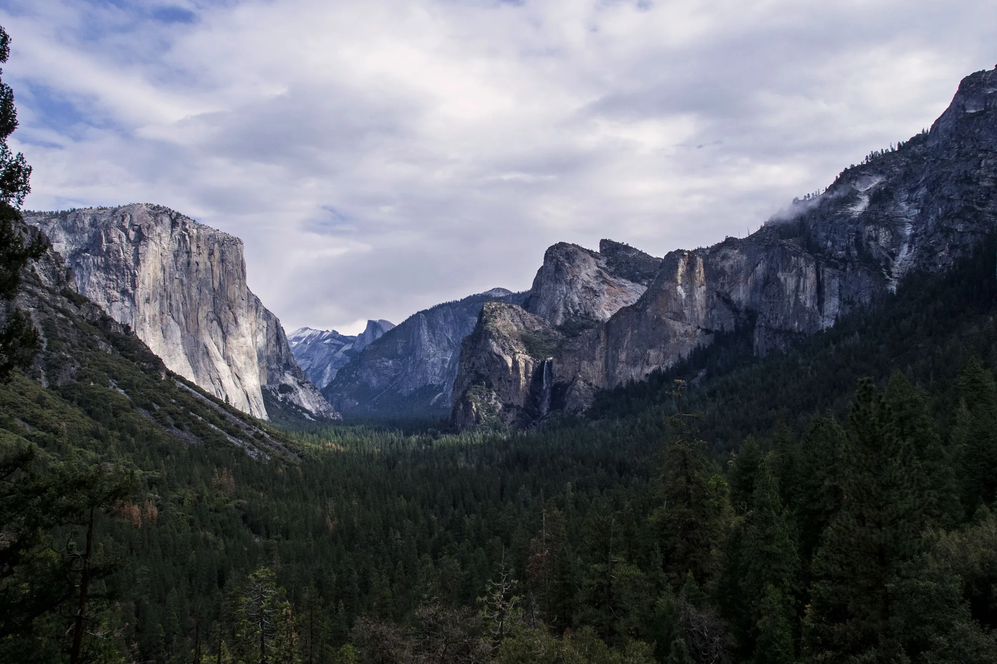
Drive up out of the Wawona Tunnel and the valley arrives all at once: El Capitan on the left, Bridalveil Fall drifting sideways in the wind on the right, Half Dome holding the far end like a signature. Most visitors get exactly one good look at all three in the same frame, and this is it.
What the view does not announce is how differently old everything in it is. The granite came first, and not in one pour. Yosemite sits on roughly thirty-five separate intrusions of the Sierra Nevada Batholith, magma that pushed up from miles underground and crystallized slowly over a run of time between about 120 and 85 million years ago. Different pulses, different chemistry, different ages, stacked against each other under the surface for tens of millions of years before anyone would ever call it a valley.
The valley itself is a much more recent edit. Rivers had already cut a canyon into that granite; glaciers came later and did the rest, grinding the canyon into the wide, flat-bottomed trough visible today and polishing the walls smooth on their way through. Compared to the granite underneath it, the shape of the valley is barely finished. It is still, in a real sense, being worked on: rockfalls off these same walls are a documented, ongoing, monitored event here, not a one-time act finished millions of years ago.
- Sierra Nevada Batholith granite 120–85 MILLION YEARS OLD
- Individual granite intrusions in Yosemite ~35
- Valley shape CUT BY RIVERS, WIDENED AND POLISHED BY GLACIERS
Protected Before "National Park" Was a Word for Anything
The 1864 Yosemite Grant is easy to walk past, because it does not sound like a beginning. Abraham Lincoln signed it on June 30, 1864, ceding Yosemite Valley and the Mariposa Grove of giant sequoias to the state of California, on the condition that both stay public and undeveloped forever. Yellowstone, usually credited as the first national park, was still eight years away. There was no category yet for what this was. Congress simply decided a piece of scenery mattered enough to keep out of private hands, in the middle of a war that was, at that exact moment, going badly.
It took John Muir to widen the fight. In 1889 he found sheep grazing tearing apart the meadows just outside the Grant's own boundary, land the 1864 law never covered because nobody had thought to protect anything beyond the valley floor and the sequoias themselves. Muir teamed up with Robert Underwood Johnson, an editor at Century Magazine, and the two of them lobbied Congress directly. On October 1, 1890, it worked: Congress created Yosemite National Park, more than 1,500 square miles of the surrounding high country, roughly the size of Rhode Island, and Benjamin Harrison signed it.
For sixteen years after that, the geography made no sense on paper. A federal national park surrounded a state-run island, the original valley and grove, still managed separately under the 1864 grant. California finally ceded that island back to federal control in 1906, and only then did the two pieces become the one park people mean today when they say Yosemite.
- 1864 LINCOLN SIGNS THE YOSEMITE GRANT
- 1890 HARRISON CREATES YOSEMITE NATIONAL PARK AROUND IT
- 1906 CALIFORNIA CEDES THE VALLEY, MAKING IT ONE PARK
Three Thousand Feet of the Same Rock
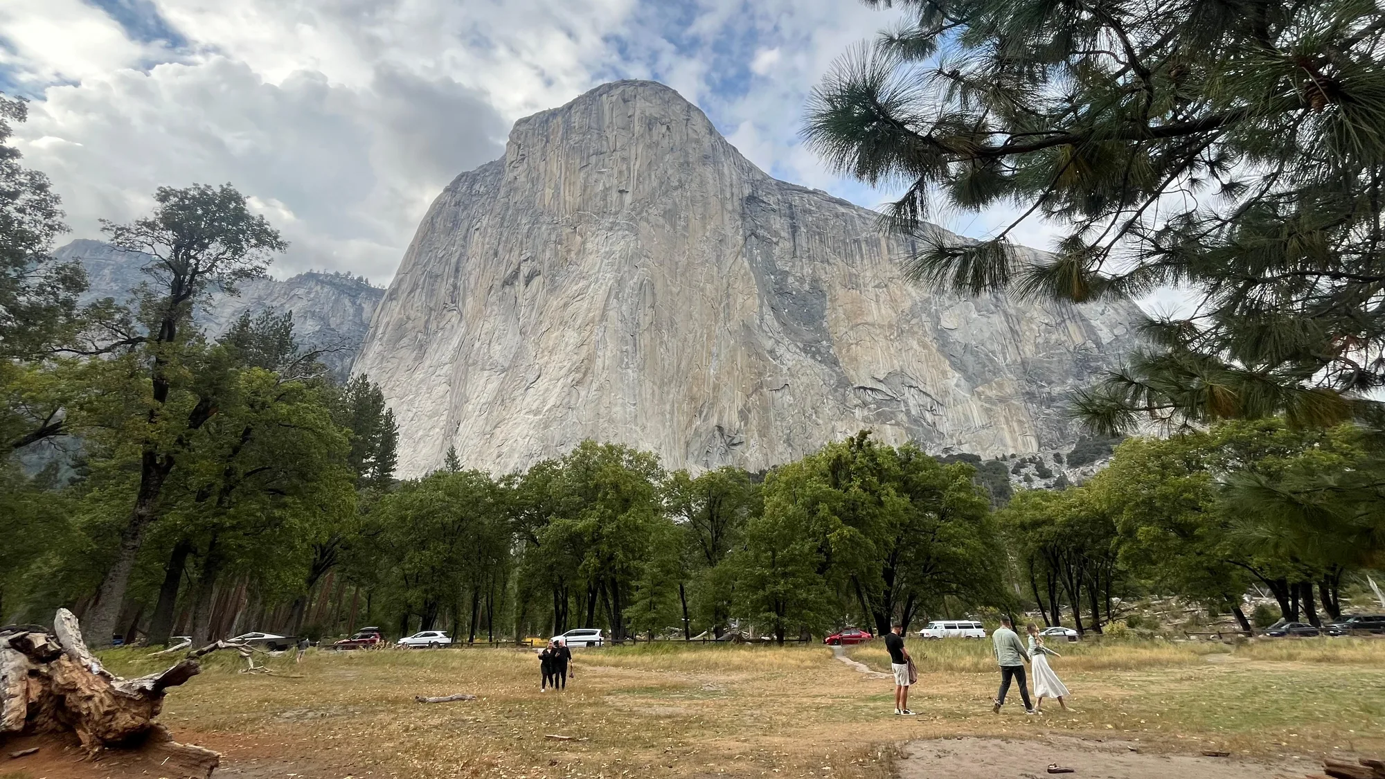
Lie down in the meadow and look straight up. El Capitan rises about 3,000 feet from base to summit along its tallest face, one of the largest single pieces of exposed granite anywhere on Earth, most of it around 100 million years old. In 1958, Warren Harding, Wayne Merry, and George Whitmore became the first people up it, climbing The Nose over 47 days of siege tactics: fixed ropes, established camps, pitons driven into the rock one at a time.
On June 3, 2017, Alex Honnold climbed the same wall, a different route called Freerider, with no rope at all. He started at 5:32 in the morning and stood on top at 9:28, three hours and fifty-six minutes after leaving the ground, the first and so far only person to free solo El Capitan. The documentary made about it, Free Solo, won an Oscar the following year.
Both climbs are true at once, and that is the point of standing in this meadow rather than reading about it. Forty-seven days versus four hours is not really a story about getting faster. It is a story about the same 3,000 feet of rock meaning something completely different depending on who is looking up at it, and when.
Turn This Route Into a Real Plan
Pick your dates and your crew: the AI trip planner builds the day-by-day for Yosemite Valley, shuttle stops and drive times included.
Open the Trip PlannerThe Tallest Waterfall in North America, Most of the Year
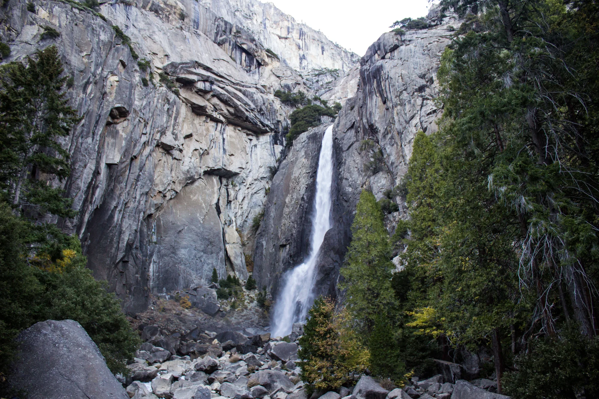
Yosemite Falls drops 2,425 feet total, measured from the lip of the upper fall to the base of the lower one. It happens in three distinct stages: the Upper Fall alone plunges 1,430 feet, a series of cascading drops in the middle add another 675, and the Lower Fall closes it out with 320 feet in full view of the valley floor. A paved half-mile path gets almost anyone to the base of the lower drop without a real hike.
None of it is guaranteed. The fall is fed almost entirely by snowmelt, which means it roars in May, thins through summer, and in most years stops running altogether by late summer or fall, leaving a dry granite cliff where a waterfall was a few months earlier. The valley's most famous piece of moving water is, for a real stretch of the calendar, not moving at all.
Granite Steps Cut by Water That Is Still Cutting
From Happy Isles, the Mist Trail climbs alongside the Merced River to Vernal Fall, a 317-foot drop that soaks the trail's granite steps in spray on the way up. It is the one stop on this route where the valley's larger story, ancient rock, recent water, shows up under your own boots instead of across a parking lot.
It is also where the park is most direct about a real danger. Swimming above Vernal Fall, in the Emerald Pool and Silver Apron area, is illegal, and the current warning exists because people have died there despite it: three visitors were swept over the fall in a single day, July 19, 2011. The water above the fall looks calm. It is not. Stay on the trail, stay behind the railings, and treat every "no swimming" sign here as the reason it exists.
What the Valley's Most Famous Shape Actually Is
Reaching the top today means climbing the last 400 feet of bare rock on steel cables, a route built in 1919 on the same line George Anderson had drilled eyebolts into by hand back in 1875. Since 2010, a permit has been required to go beyond the subdome: 300 a day, roughly 225 day hikers and 75 backpackers, split between a preseason lottery in March and a much smaller daily lottery two days out. Ten dollars to apply, ten more per person if you are picked. Most applicants are not.
The cables are only up from the Friday before Memorial Day through the day after the second Monday in October, and they are dangerous wet: ten confirmed deaths have happened on that route since 1919, most of them on rock made slick by rain. It is a hike that rewards exactly the caution the permit system is designed to force on people who might otherwise skip it.
And about the shape itself: it really is roughly eighty percent of the original rock still standing, not a mountain sawn in half. What looks like a missing piece from the valley floor is a trick of the one angle Tunnel View gives almost every visitor. Walk or drive around to the back of Half Dome and the illusion falls apart entirely: the smooth curved slope most photographs never show turns out to be most of the mountain.
Look at It From the Back Before You Leave
Rockfall here is real and ongoing, not a one-time event finished millions of years ago; check current conditions before setting a route near any wall, and give freshly fallen talus a wide berth. Water in this valley, from the falls to the Merced, is colder and faster than it looks from a dry trail.
Drive back out through the Wawona Tunnel at the end of it and Tunnel View is right there again, the same three landmarks in the same frame. Only now Half Dome reads differently. It is not a mountain missing its other half. It is a mountain that, from exactly one angle, out of every angle it can be seen from, looks like something it has never actually been.
Granite age, batholith intrusion count, and valley formation checked against NPS.gov's own geology pages for Yosemite. Waterfall heights (Yosemite Falls, Vernal Fall), the 1864 Grant and 1890/1906 park history, El Capitan's climbing history, and the Half Dome cable and permit system were checked against NPS.gov's current visitor-planning pages and cross-referenced against independent public records for dates and figures. Where a figure is commonly rounded (Half Dome's elevation, the exact share of the original dome remaining) we said so as an estimate rather than a false-precise number.