
In the summer of 1863, a Mormon homesteader named Isaac Behunin stood in this canyon with a few friends and said the thing that gave the park its name. "A man can worship God among these great cathedrals as well as he can in any man-made church," he told them. "This is Zion." He was looking up at sandstone walls that rise as much as 2,000 feet straight off the canyon floor, walls that look, honestly, like they were built to outlast everything.
They weren't. The rock over Behunin's head is some of the softest, youngest stone in the entire national park system, and the river at his feet was already taking it apart. That tension, cathedral-scale walls made of rock soft enough to crumble in your hand, runs under almost everything else here: why the canyon looks the way it does, why you can't drive your own car through most of it anymore, and why the park's most famous trail now requires a lottery ticket.
Too Hard to Pronounce
Long before Behunin arrived, Southern Paiute people who had lived in the region since roughly AD 1100 called this place Mukuntuweap, "straight canyon," a name earlier Puebloan and Fremont groups' own 7,000 years of presence had never left written down. When President William Howard Taft protected 16,000 acres of it as a national monument on July 31, 1909, he kept that name: Mukuntuweap National Monument.
It didn't last. Horace Albright, then the acting director of the fledgling National Park Service, visited in 1917 and decided the name was a tourism problem. "I felt 'Mukuntuweap' was too difficult to pronounce and really tough to spell," he said, and he'd noticed locals already just called it Zion anyway. He took the case to Washington. President Woodrow Wilson renamed it Zion National Monument in 1918, and Congress made it Zion National Park in 1919.
The rename worked, at least by the metric Albright cared about. About 300 people visited under the Mukuntuweap name in 1914. Zion's first full year as a national park, 1919, drew 1,814. Today the park draws roughly 4.5 million visitors a year, the third-most of any national park in the country, on a name a park official picked partly because it was easier to say.
- 1914 visitors (as Mukuntuweap) ~300
- 1919 visitors (first year as Zion) 1,814
- 2019 visitors ~4.5 MILLION
A Farm in a Cathedral
Behunin's declaration wasn't a tourist's first reaction. He and his sons built a cabin and farmed the canyon floor starting that same summer of 1863, an ordinary Mormon homesteading operation set inside what a geologist would later measure as one of the tallest exposed rock faces in North America. He kept the farm until 1872, when he sold it to William Heaps and moved his family to Long Valley, but he split winters at a home in nearby Springdale the whole time, treating the canyon as a place to work as much as a place to marvel at.
He wasn't the first person to live there by a long distance. Nomadic groups had used the canyon for roughly 7,000 years before Behunin's cabin went up, and the Virgin Branch Puebloan and Fremont peoples had settled it more permanently before Southern Paiute tribes moved in by around AD 1100. The straight-walled canyon the Paiute named Mukuntuweap and the sanctuary Behunin named Zion are the same piece of ground, described twice, roughly seven centuries apart, by people who'd both decided it meant something.
Turn This Route Into a Real Plan
Pick your dates and your crew: the AI trip planner builds the day-by-day for Zion, shuttle stops and trailheads included.
Open the Trip PlannerA Fossilized Sahara
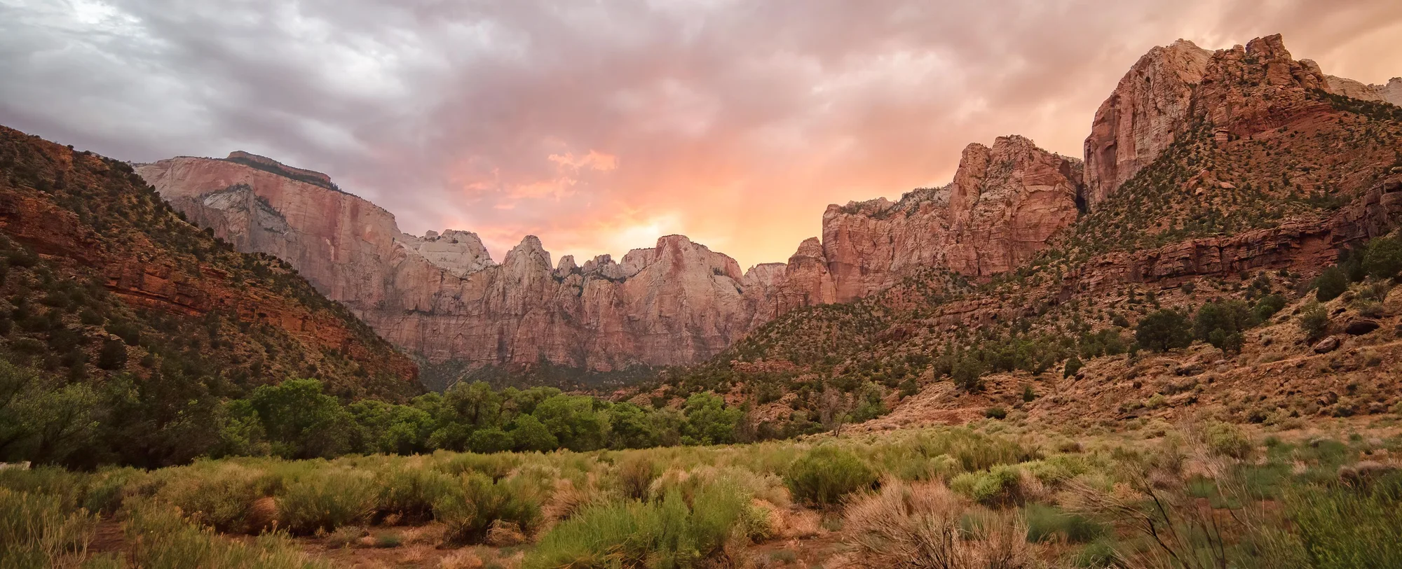
The rock that makes up nearly every famous view in Zion is called Navajo Sandstone, and it started as sand, not stone. Around 180 million years ago, a desert bigger than the Sahara, roughly 150,000 square miles of it, covered what's now the American Southwest, and wind piled sand from as far away as present-day Nevada into dunes across it for about 10 million years. Those dunes eventually got buried, compressed, and cemented together, weakly, by calcium carbonate and iron oxide, into the pale tan and red rock visitors see today. At the Temple of Sinawava, near the head of the canyon, that formation reaches its full thickness: about 2,200 feet.
The angled, sweeping lines you can see in the cliff faces, cross-bedding, geologists call it, are fossilized dune slopes, frozen mid-migration. And because the cement holding the sand grains together is weak, the rock is genuinely friable: it crumbles easily and stays porous long after it's technically stone. Zion's walls look like they were carved from something permanent. They were carved, comparatively fast, from something that's still, in a real sense, sand.
Faster Than the Grand Canyon
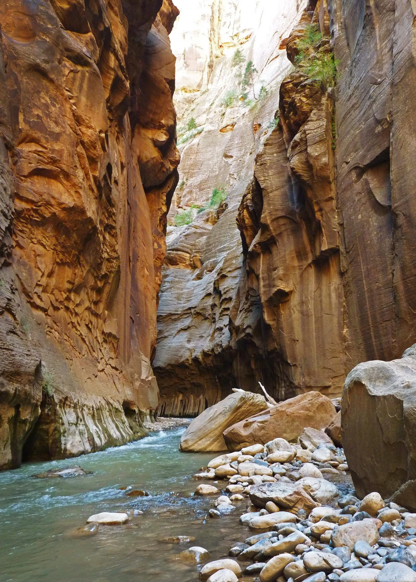
The Virgin River carved Zion Canyon out of that soft sandstone, and it did it fast by geological standards. Over roughly the last 2 million years, the river has removed about 6,000 feet of sediment that once sat above the rock layer now exposed at the canyon floor, cutting 1,300 feet of that in a single million-year stretch, a pace that matches the Grand Canyon's fastest recorded erosion periods. The mechanism isn't just water wearing rock down grain by grain. Flood-stage water, thick with sediment and abrasive, undermines cliff faces until whole vertical slabs shear off and fall, a process the friable, vertically jointed sandstone makes especially easy. A 1998 flood pushed the river's flow from a normal 200 cubic feet per second to 4,500, more than twenty times its usual volume, in the span of a storm.
The river isn't finished. Geologists estimate it can cut roughly another thousand feet down before it loses the slope and force needed to keep carrying sediment away. Stand in the Narrows and look up: the walls on either side are a work in progress, not a finished monument, and the river underfoot is the reason.
The Road That Isn't Yours Anymore
Since May 26, 2000, most visitors haven't been allowed to drive their own cars up Zion Canyon Scenic Drive. A free shuttle runs the 6.5 miles between the visitor center and the Temple of Sinawava instead, stopping at nine named points along the way: the Zion Canyon Visitor Center, the Zion Human History Museum, Canyon Junction, Court of the Patriarchs, Zion Lodge, The Grotto, Weeping Rock, Big Bend, and the Temple of Sinawava itself, where the paved Riverside Walk picks up and the Narrows begins.
The park built the system to fix a problem that was already visible: overflowing parking lots, visitors turned away or giving up and leaving, and what the Park Service's own planning language called congestion, noise, pollution, and resource damage. It worked partly because Zion had a geographic advantage most large parks don't. The Scenic Drive is a dead end, not a through-route, which makes shuttle-only access actually enforceable in a way it never has been at Yosemite or Yellowstone. The system was built to handle 2.42 million annual visitors. It takes roughly 4,000 individual car trips off the road every day, and costs the park about a dollar per visitor per year to run.
- Started MAY 26, 2000
- Vehicle trips removed daily ~4,000
- Cost per visitor, per year ~$1
The Permit for the Plank
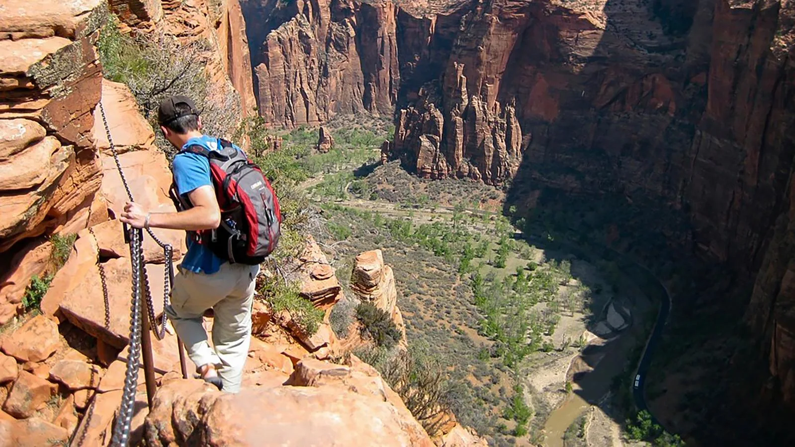
The last half-mile of Angels Landing runs along a narrow sandstone spine with drop-offs on both sides, steep enough that the Park Service bolted chains into the rock so hikers have something to hold. It's the same soft, friable Navajo Sandstone described three stops back, which means the handholds and footing that keep people alive up there are cut into rock that's actively crumbling, not granite.
As Zion's visitation climbed from 2.8 million in 2011 to nearly 4.5 million by 2019, the trail got crowded enough, and dangerous enough in the bottlenecks that crowding created, that the park started metering hikers in 2019 and again in 2021. On April 1, 2022, that became a permanent permit system: apply through a seasonal lottery or a same-day lottery for the next day's hike, pay six dollars to enter, and pay three dollars more per person if you're selected. The fees fund the lottery system itself and extra ranger staffing on the trail. Winning gets you a chance at one of the most photographed views in the park system. It also gets you five hundred feet of chain, soft rock under your boots, and a drop that doesn't care how you got the permit.
Ride the Shuttle, Respect the Rock
Zion rewards patience more than most parks: park early or take the shuttle from Springdale, ride the full line at least once before picking a trailhead, and remember that the walls around you are softer and younger than they look. Stay on marked trails, keep off closed sandstone during wet weather when it's most likely to shear, and if Angels Landing is the goal, apply for the lottery before the trip, not after you've already driven there.
The Virgin River is still cutting, the same river that undercut the ground under Behunin's cathedral, and geologists figure it has roughly another thousand feet of rock left to remove before it runs out of force. The walls look permanent. They aren't finished.
Facts and figures checked against NPS.gov and USGS.gov, including Zion's naming history, Navajo Sandstone geology and erosion rates, the shuttle system's 2000 launch, and the 2022 Angels Landing permit system. Visitation figures are annual averages; where a specific year's count is cited, it's noted as such above.