
In 1832, forty years before Yellowstone, President Andrew Jackson signed a bill setting aside four sections of land around a cluster of springs in the Ouachita Mountains, reserved, in the law's own words, for the future disposal of the United States. There was no National Park Service yet. There was no category called national park yet. That distinction goes to Yellowstone, officially, in 1872. But the protection itself, a government setting land aside so nobody could privately claim it, happened here first, under a different name, four decades early.
Hot Springs National Park doesn't advertise itself the way Yellowstone or Yosemite do. It's a downtown, not a wilderness: eight Gilded Age bathhouses lined up on a single street, a working spa still open for business, and, for a stretch of the twentieth century, one of the more useful places in America for a wanted man to disappear in plain sight. All five stops on this walk sit within about a half mile of each other, Central Avenue and the mountain rising directly behind it, which makes it one of the only national park tours you can do entirely on foot between breakfast and lunch.
The Most Elegant Bathhouse on the Row
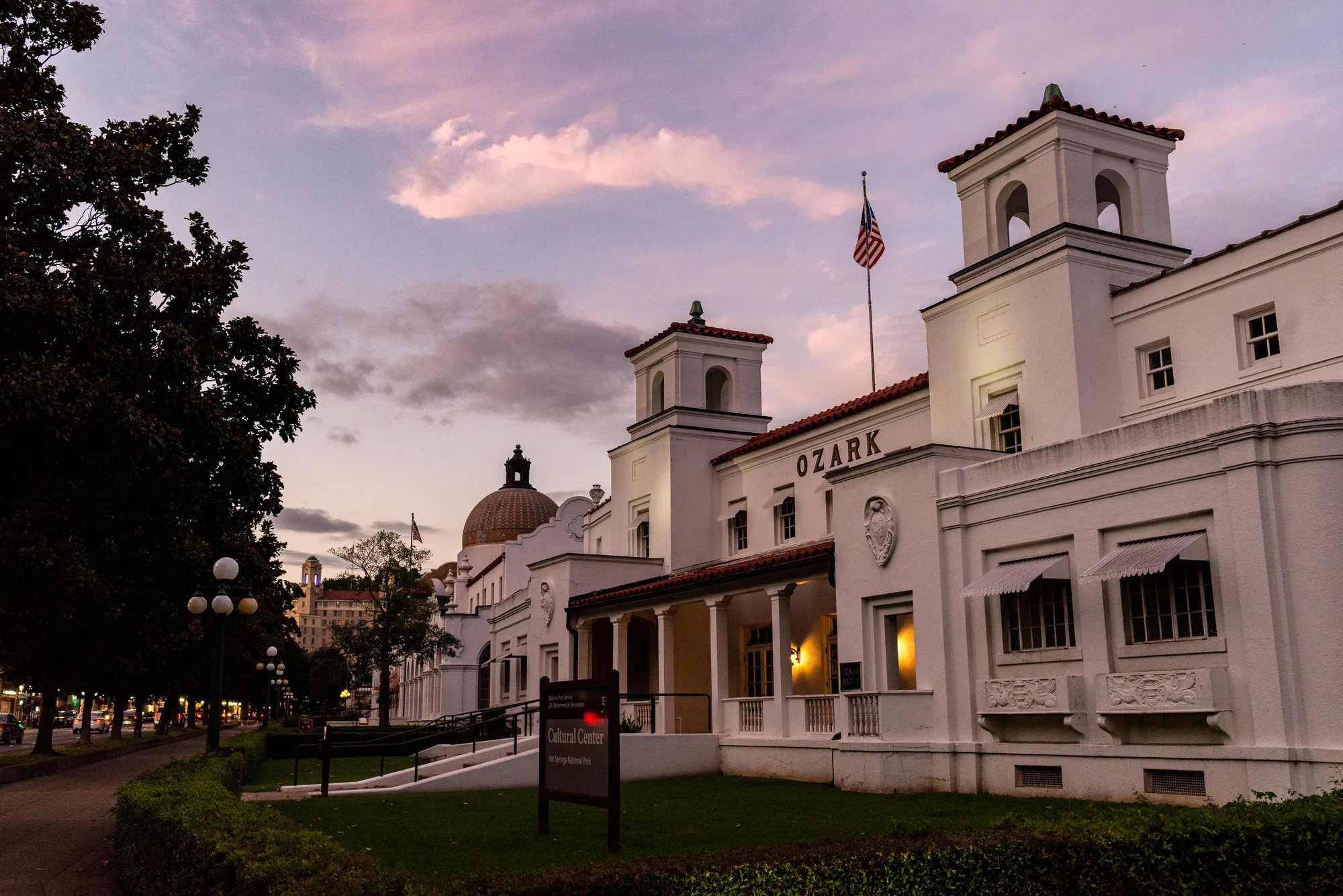
Yellowstone gets the credit for being first, and by the letter of the law it's earned: Congress didn't use the exact phrase "national park" until 1872, and this ground didn't take the name Hot Springs National Park until 1921. But the 1832 act Jackson signed did the same essential thing four decades earlier, under a different label. It set the land apart from private sale specifically so the public would always have access to it. Hot Springs likes to call itself the oldest national park in the system. That claim rests on an honest technicality, not a fabrication, and it's the kind of distinction worth knowing rather than smoothing over.
The building in front of you settles the other half of this stop's story. Fordyce opened on March 1, 1915, cost more than $212,000 to build, equip, and furnish, and at roughly 28,000 square feet is the largest of the eight bathhouses on this row. It ran as a working bathhouse for 47 years, closing on June 30, 1962, then sat empty for more than two decades before the National Park Service restored it and reopened it as the park's visitor center in 1989. Everything else on this walk starts from here, which fits: Fordyce was built to be the grandest possible version of what every bathhouse on this street was actually selling, a few hours in water that had spent thousands of years underground before it ever reached a tub.
- APR. 20, 1832 HOT SPRINGS RESERVATION ESTABLISHED BY ACT OF CONGRESS
- 1872 YELLOWSTONE OFFICIALLY DESIGNATED FIRST "NATIONAL PARK"
- MAR. 1, 1915 FORDYCE BATHHOUSE OPENS, $212,000+ COST
- MAR. 4, 1921 REDESIGNATED HOT SPRINGS NATIONAL PARK
- 1989 FORDYCE REOPENS AS PARK VISITOR CENTER
What's Confirmed, and What's Legend
This bathhouse takes its name from the Quapaw, one of several nations, alongside the Caddo, Osage, and Tunica, whose presence here is verified by the park's own history and by an on-site historical marker: people quarried novaculite, a hard stone used for tools and weapons, from these mountains for at least 10,000 years, working one of only two natural novaculite outcrops anywhere in North America. That much is documented.
What isn't documented the same way is the popular story that rival tribes treated this valley as neutral ground, a place where warriors from opposing nations could bathe within sight of each other under an unspoken truce. It's a good story, repeated often enough in local guidebooks that it's easy to mistake for settled history. It comes down through local and oral tradition rather than anything the park service has been able to confirm on the record, and the honest version of this stop keeps that distinction, rather than folding a legend into a fact just because they sit in the same valley.
Quapaw itself opened in 1922, cost more than $214,000, closed in 1984 like most of its neighbors, and then did something none of the others managed: it reopened as an actual working bathhouse rather than a museum or a shop. It's the only stop on this walk where you can still do the thing this entire street was built for, soak in the same thermal water in a large shared pool instead of a private tub, closer to how bathing here worked for most of this row's history than any single-visitor version is.
Turn This Route Into a Real Plan
Pick your dates and your crew: the AI trip planner builds the day-by-day for Hot Springs, walking order between stops included.
Open the Trip PlannerWater That Fell Before Rome Existed
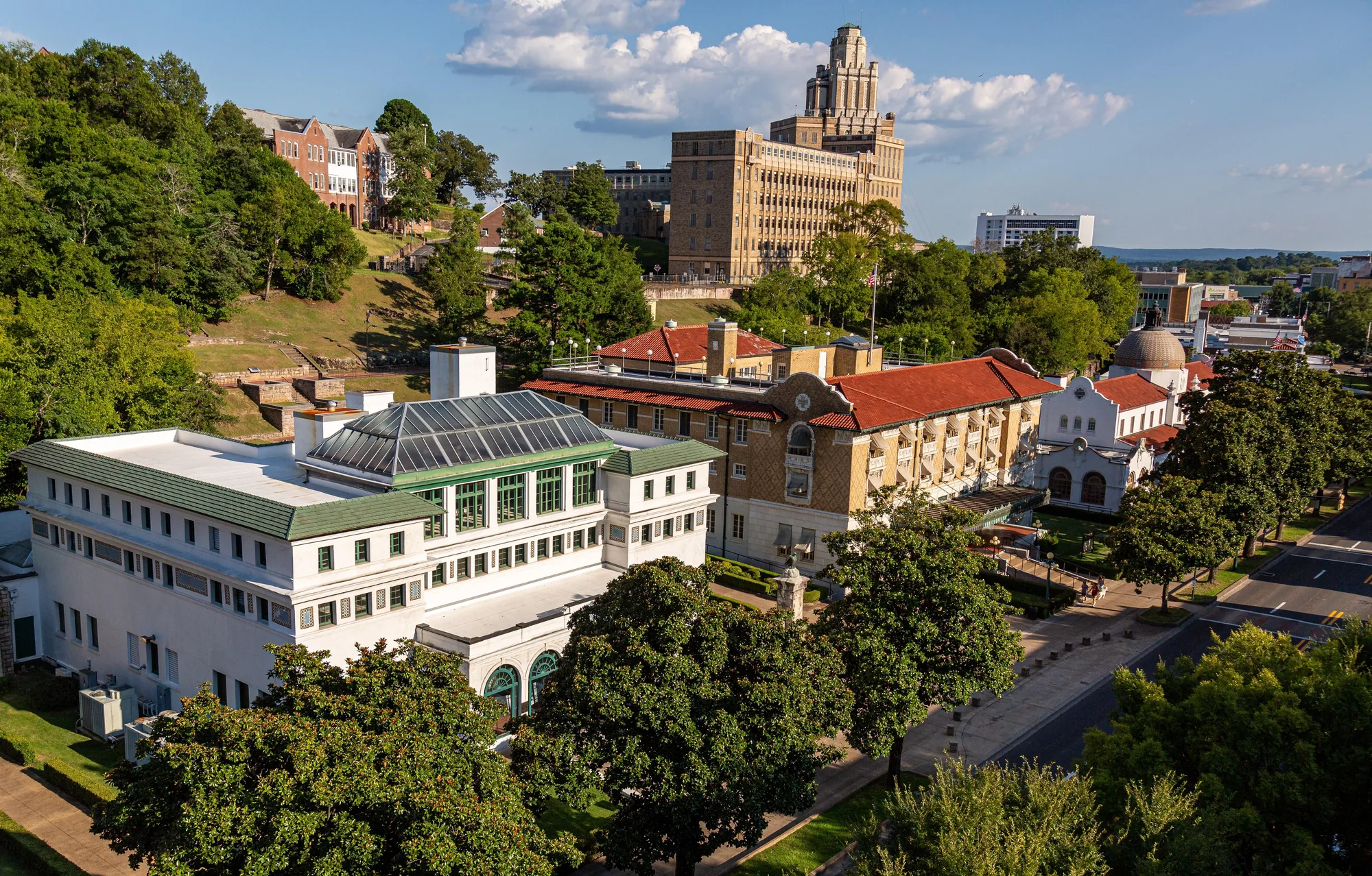
The water under this entire street started as ordinary rain, and by the park's own hydrology, some of it has been underground for more than 4,000 years, working down through cracks in the rock to somewhere between 2,000 and 8,000 feet before turning around and coming back up. Nothing volcanic heats it. The rock simply gets warmer the deeper you go, an ordinary geothermal gradient, and by the time this water resurfaces it averages about 143 degrees Fahrenheit.
Forty-seven springs do this here, 35 of them actively monitored, together sending more than 600,000 gallons a day into the system that supplies every bathhouse on this row. Every tub on Bathhouse Row, in other words, is filled with rain that fell before most of recorded history happened, and the timeline is the actual attraction here, more than the temperature is.
The walkway itself has a simpler origin. It's a half mile of solid brick running behind the bathhouses, and the design wasn't invented locally: the park's own history credits the Prado, a pedestrian promenade in Havana, Cuba, as the direct inspiration. It gave Hot Springs something most resort towns of the era never bothered building, a formal public walkway meant purely for strolling, with benches, shade, and views back toward the mountain. It's still the best vantage point for all eight bathhouse facades at once, from ground level, rather than the sidewalk out front.
Al Capone's Table Had a Clear View of the Room
The building at 250 Central Avenue sells wax figures today. From 1893 through the 1960s, it was the Southern Club, one of the most popular illegal casinos in a city that, according to the Encyclopedia of Arkansas and the Mob Museum's own reporting, ran wide-open gambling for the better part of a century while local authorities simply taxed it instead of shutting it down. Al Capone was a regular customer through the 1920s and 1930s, and by multiple accounts he always sat at the same elevated table, the one with a clear view of the entire room.
He wasn't the only name. Lucky Luciano stayed at the Arlington Hotel, a few blocks from here, in 1936. Owney Madden, a New York gangster with the New York State Parole Board's actual permission to relocate, moved to Hot Springs in the mid-1930s and simply stayed, marrying a local postmaster's daughter and living here until his death in 1965. For a stretch of the twentieth century, a spa town built around therapeutic bathing doubled as one of the more useful places in America for a wanted man to disappear in plain sight.
It didn't end quietly. On August 17, 1967, state police acting on Governor Winthrop Rockefeller's direct order raided the gambling clubs along this street and confiscated the equipment, months after Rockefeller had vetoed a bill that would have legalized gambling at four private clubs instead. That's the clean version of the ending. The uglier one is older: back in 1899, a shootout between city police and county sheriff's deputies over who actually controlled gambling here left five people dead, more than died at the O.K. Corral. The glamour came later. The fight over this street's money was already violent before anyone famous ever sat down at a table on it.
The Third Tower on This Exact Spot
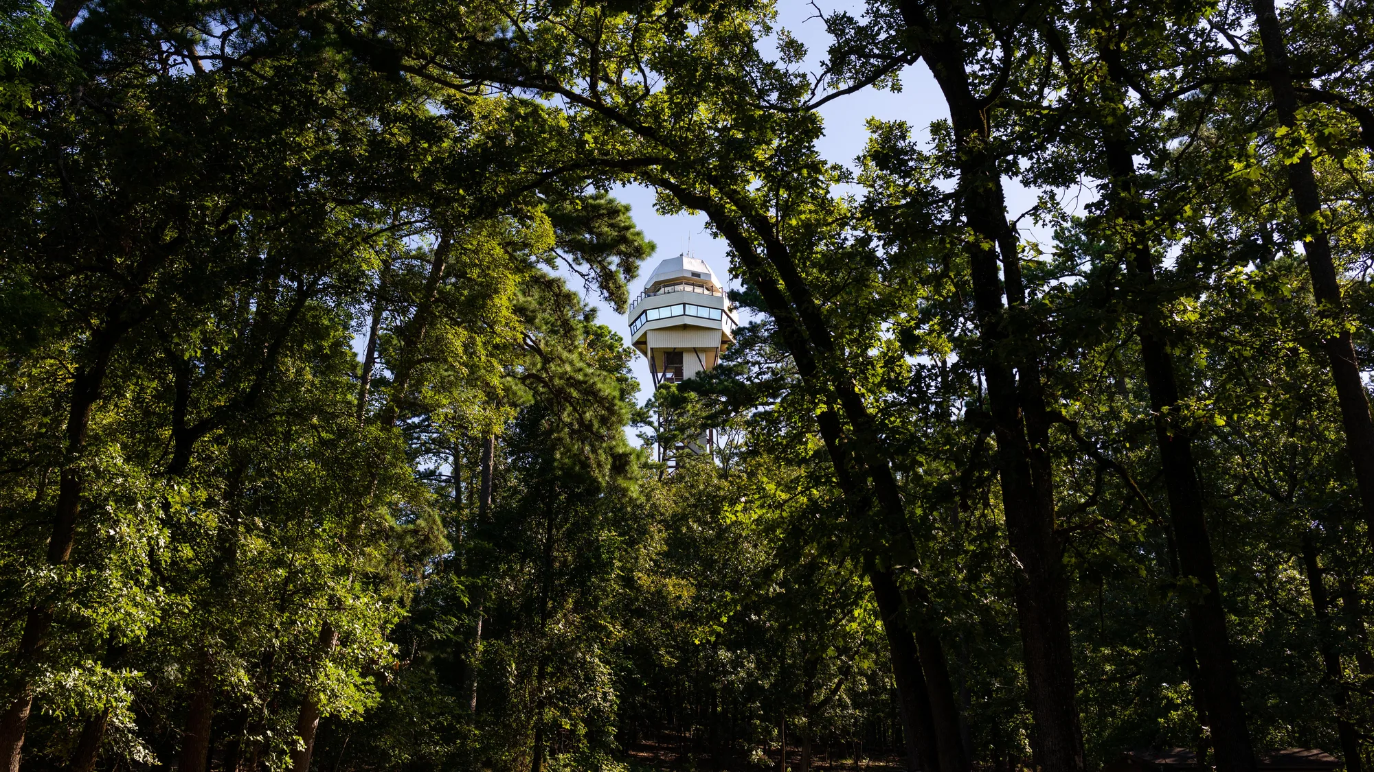
This isn't the first observation tower on this hilltop. Enoch Woolman built an 80-foot wooden tower here in 1877, replaced in 1906 by a taller steel tower put up by a local bank president named Charles Rix, which stood until it was demolished in 1971. The current tower opened to the public on June 3, 1983: 216 feet tall, its upper deck sitting 1,256 feet above sea level, with a view the park describes as covering roughly 140 square miles of the surrounding Ouachita Mountains. Three different structures, spanning close to a century and a half, all built to do the same one thing from the same one hilltop.
From this deck you can trace almost everything on this walk without moving your feet: Bathhouse Row directly below, Fordyce's roofline and the Promenade's brick path running behind it, the wax museum a few blocks down Central Avenue that used to be the Southern Club, and beyond all of it, the Ouachita Mountains the 1832 reservation was carved out of, decades before Washington had a name for what that kind of protection was supposed to be called. The water is still down there, still more than 4,000 years old, still surfacing at 143 degrees, whether or not the word "park" had been invented yet when someone first decided this ground was worth setting aside.
The 1832 federal reservation, its comparison to Yellowstone's 1872 designation, and the 1921 national park redesignation checked against NPS.gov's own Hot Springs history pages and Earth magazine's reporting on the original 1832 act. Fordyce Bathhouse's opening date, cost, closure, and 1989 restoration checked against NPS.gov's own Fordyce Bathhouse page; Quapaw Bathhouse's cost and closure year cross-checked against Bathhouse Row's own construction record. The water's age, depth, temperature, spring count, and daily flow checked against USGS.gov's hydrology and geology pages for the park. The Grand Promenade's design and its Havana Prado inspiration checked against NPS.gov's own Grand Promenade place page. The Native American quarrying history and the honest hedge on the "neutral ground" legend checked against NPS.gov and an on-site historical marker (Native Americans and Quarries, Hot Springs Historic Baseball and Heritage Trail). The Southern Club, Al Capone, Owney Madden, Lucky Luciano, and the August 17, 1967 raid checked against the Encyclopedia of Arkansas and the Mob Museum's own reporting, cross-checked against each other. Coordinates for every stop on the companion audio tour were checked against on-site historical-marker transcriptions (hmdb.org). Hot Springs Mountain Tower's construction history and dimensions checked against NPS.gov and an on-site historical marker (Mountain Towers).